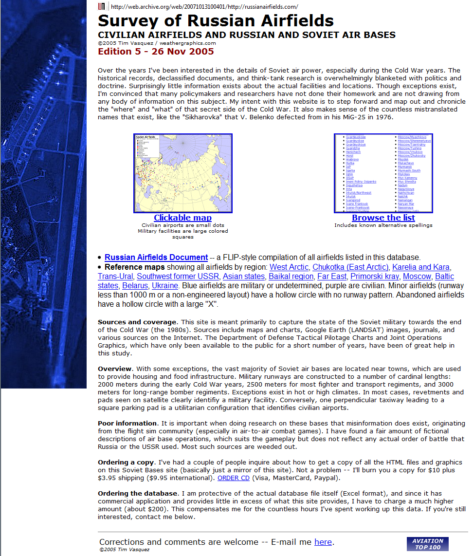
|
|
||||||||||||||
|
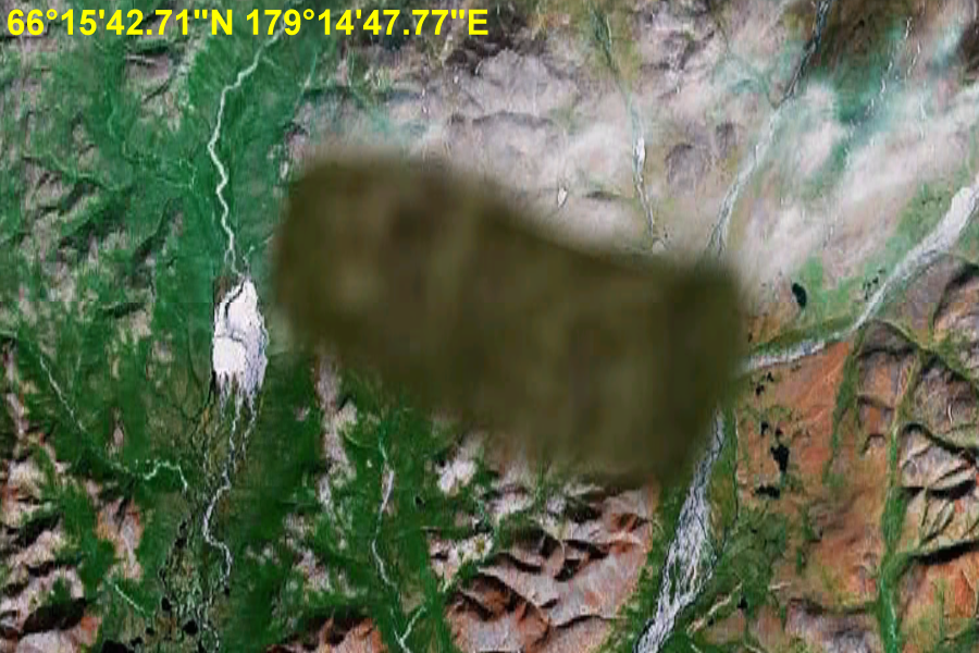
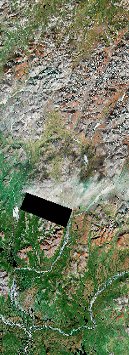
Unknown ICBM Facility Chukotka Autonomous Okrug No longer in Service? 66°15'42.71"N 179°14'47.77"E ..
Chukotka Autonomous Okrug Chukotka Autonomous Okrug (Russian: Чуко́тский автоно́мный о́круг, tr.: Chukotsky avtonomny okrug; Chukchi: Чукоткакэн автономныкэн округ, tr: Chukotkaken avtonomnyken okrug), or Chukotka (Чуко́тка), is a federal subject of Russia (an autonomous okrug) located in the Far Eastern Federal District. Chukotka has an area of 737,700 km2 (284,800 sq mi) and a population of 53,824 according to the 2002 Census. The principal town and administrative center is Anadyr. It is the most northeasterly region of Russia and, since the sale of Alaska to the United States, has been the only part of Russia lying partially in the Western Hemisphere (east of the 180th meridian). Lake El'gygytgyn, an important site for scientific research on climate change, is located in Chukotka, as is the village of Uelen, the closest substantial Russian settlement to the United States. SOURCE: Wikipedia Chukotka Autonomous Okrug
..
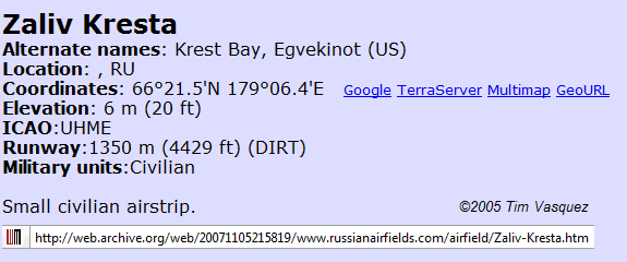
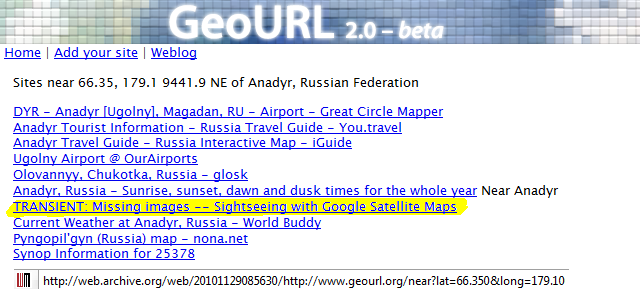
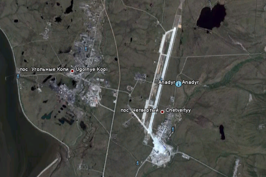
UPDATE: Zaliv Kresta Airstrip
Small civilian airstrip. SOURCE: Russian Airfileds - Note: Site was shut down Nov 2007. The information came from the Internet Archive last active page Oct 13, 2007 - [Archived] Brought to our attention by zaarin from ATS
Chukotka Autonomous Okrug 66°15'42.71"N 179°14'47.77"E ..
UPDATE: The Mystery Deepens In November 2007 the Russian Airfield website was shut down. Screen captures below from the Internet Archive from the last active page show some really interesting facts
..
..
..
Now following the links to the previously linked maps, we find all four sites do not have the images;
..
..
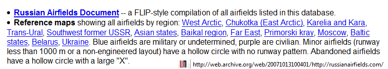
|
||||||||||||||
|
...
...
...
...
...
...
...
...
...
...
...
...
|
||||||||||||||
|
Chukotka Autonomous Okrug ...
..
..
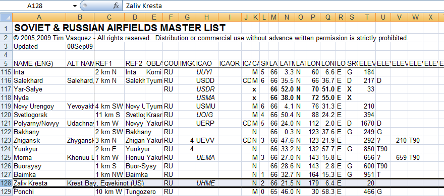
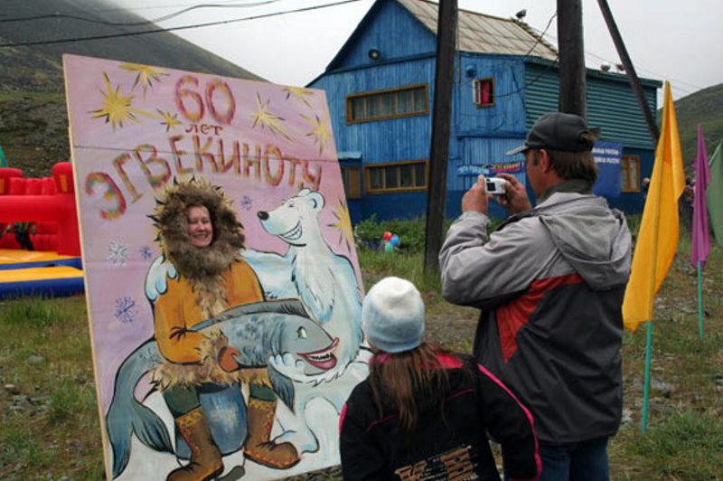
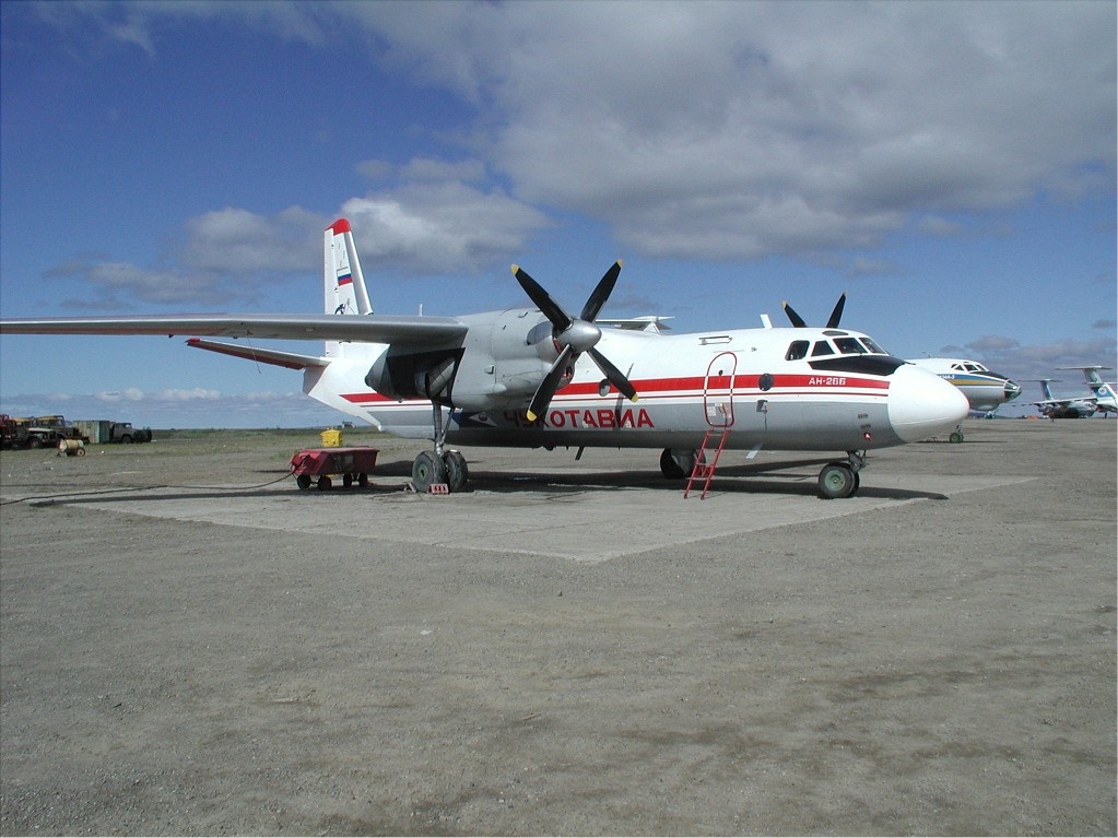
Egvekinot Settlement - This is the only city near the Russian Launch site Originally posted by zaarin a member of ATS Post ID 7526236 The name of the airbase was Zaliv Kresta, named after the nearby "Krest Bay". I have carefully studied the evidence and I conclude that SOMEBODY is going to great lengths to hide the existence of this area. I discovered from russianairfields.com that there is
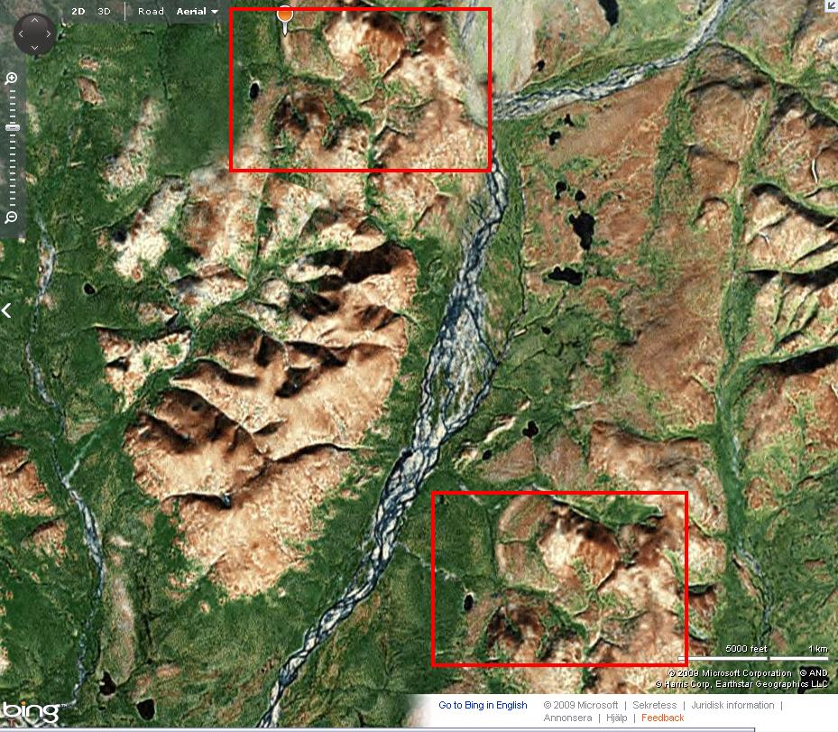
an air base in the area at;
There is a tiny runway there that basically goes north-south, about 1.3km long. Long enough for propellor planes, maybe learjets. The Russians claim this air base had been bought by the Americans. Zaliv Kresta (US) it says. It doesn't surprise me, the Russians practically advertise their ICBM capability so nobody messes with them, whereas the American Jews are all a bunch of paranoid sketchy twats who dont like anyone to know anything about them. I agree that Chelsea's Football Manager Roman Abramovich is probably involved seeing as he is the governor of the whole of Chukotka. Also, the Russian government is skint, they can't afford to pay off Google etc to hide ICBM missiles but they can make it nigh on impossible to see what is going on in this area. It seems this area has been shrouded for quite some time, whilst I don't doubt that a 1.3km runway existed there years ago, I strongly suspect that this tiny airstrip has been developed and built upon and they do not want anybody to know about what is going on there. The Americans are behind all of this, I am sure of it. That base makes an excellent strategic point against North Korea. I think the base is a CIA extraordinary rendition drop-off/refuel base. The only other way anybody could get an image of this place is by paying a private satellite company to take a snap during the next flyby. Those are my thoughts. UPDATE:
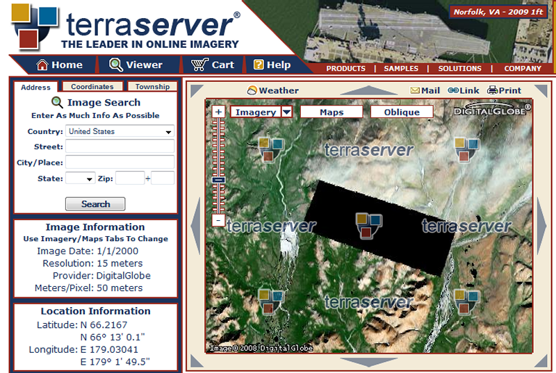
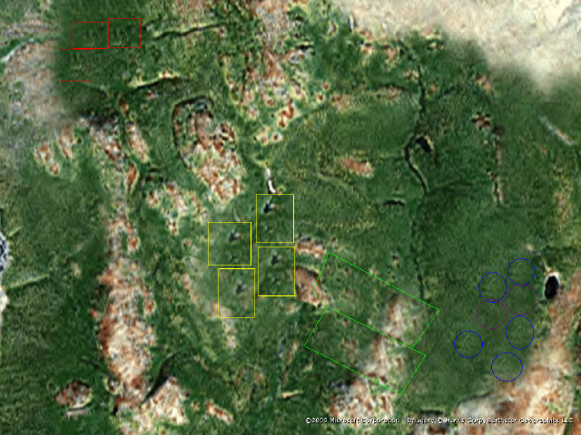
SOURCE: GE 330444
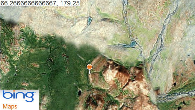
Originally posted by Saribous a member at ATS Post ID 7647361 The image you're referring to seems to have been tampered with. It looks (to me at least) like someone has pasted another area over the real one. You can see the "seams" along the edges. You can see the place they copied and put over the original on this screenshot I took (from Bing Maps)
Originally posted by sensible thought a member at ATS Post ID 7654200 I have found a few cut and pasties myself. Has anyone ever seen a place that has been blocked out by EVERY mapping site before?
Originally posted by freakyclown a member at ATS Post ID 7749935 Right I did some work on tracking down who provided the original data to places like google of the blurred out area, I then sent them a direct email asking for an explination - Today I received a reply... fc, Thank you for your TruEarth imagery inquiry. I looked into your question regarding the strange fuzzy spot that you identified in the Google Maps imagery and, yes, I have an explanation. This data looks like it did come from our TruEarth dataset that Google uses as it's global mid-resolution basemap. When examining our source data, sure enough, there is a large data drop out at the same location (see attached). In our source data, it is simply a black wedge which is indicative of a sensor dropout in the original satellite data download. It looks like Google may have patched the black missing data with the fuzzy green patch that you saw. Thanks again for your inquiry. If you have any other questions, please let me know. Best regards, Greg Baxes
(He had attached the [above]
image to the email - this does show that google added the green/brown blur
and that MS used the same data for their images - however is it really
a data drop that ALL the mappers have used/duplicated and fuzzed over...
or is it blackout for a reason? you decide!)
|
||||||||||||||
| Chukotka During World War Two
Excerpt 1
Excerpt 2
Excerpt 3
Bilibinskaya nuclear power plant, Chaunskaya thermal power plant and Ekvekinotskaya hydroelectric power plant produced abundant amounts of energy. Production of construction materials was developping in Anadyr, Pevek and Bilibino. SOURCE: Soviet
Chukotka
|
||||||||||||||
|
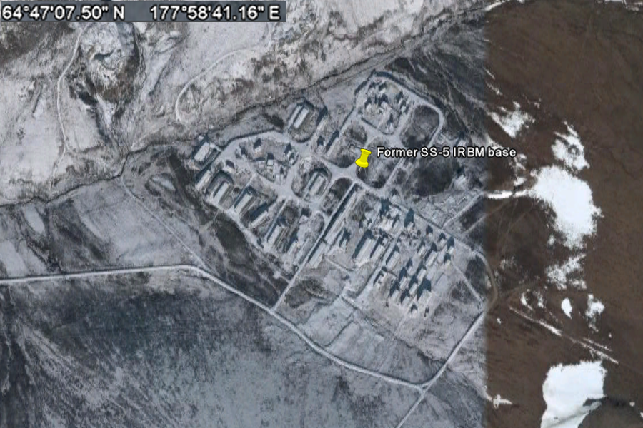
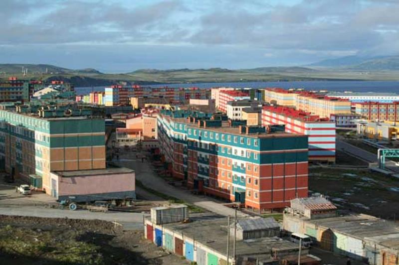
..
64°43'44.88"N 177°44'10.34"E ..
Credit: Dmitry Avdeev ..
....
....
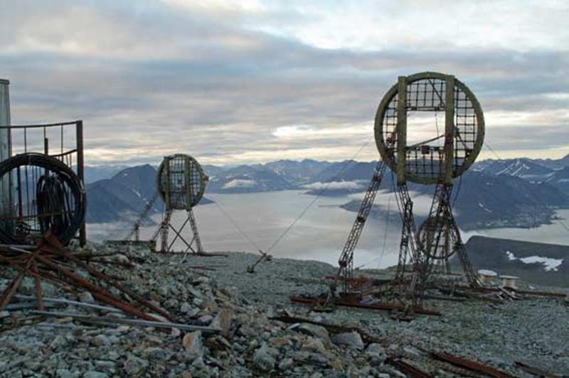
Roman Abramovich was elected governor of this region in 2000 Outside Anadyr the land still needs a major clean-up. Even the most remote settlements are scarred by piles of abandoned rusty fuel-barrels. The deserted, windowless military camp in Providenie reminds me of the Chechen capital, Grozny, after heavy shelling. The forsaken communications installations on Mount Beklemesheva look like the set of a science-fiction film about a mysterious civilisation that perished in unknown circumstances. There are other obstacles to developing ecotourism in the region. Every time the helicopter lands, uniformed border-patrol officers check our documents. According to federal regulations Chukotka is a restricted zone for visitors. An entry permit takes forty-five days to organise. The unpredictable weather can ruin any trip, a gamble made worse by the limited working hours of airports and air-traffic control services. SOURCE: opendemocracy.net
By RMBK1000 Gudym military site 800km from US border. There have been heavy military machinery on the parking (west), planned to be used for invasion of Alaska. This invasion should be the second step, after a nuclear strike. The nuclear shelter is placed inside of the south mountain (entrance south east). source:"Geheimes Russland - 4v6 - Tschukotka - Die vergessene Armee" documentation. - SOURCE |
||||||||||||||
| FAIR USE NOTICE: This page contains copyrighted material the use of which has not been specifically authorized by the copyright owner. Pegasus Research Consortium distributes this material without profit to those who have expressed a prior interest in receiving the included information for research and educational purposes. We believe this constitutes a fair use of any such copyrighted material as provided for in 17 U.S.C § 107. If you wish to use copyrighted material from this site for purposes of your own that go beyond fair use, you must obtain permission from the copyright owner. | ||||||||||||||
|
|