|
|
||
|
Pacific Threatened by Rising Sea Level
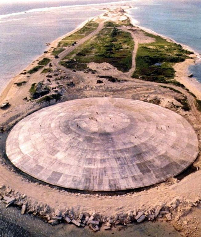
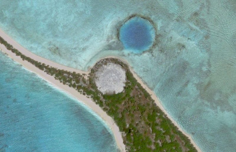
on Enewetak Atoll in the Marshall Islands Attribution:US Defense Nuclear Agency/AFP/File This dome in the Pacific houses tons of radioactive waste – and it's leaking
This dome in the Pacific houses tons of radioactive waste – and it's leaking. The Runit Dome in the Marshall Islands is a hulking legacy of years of US nuclear testing. Now locals and scientists are warning that rising sea levels caused by climate change could cause 111,000 cubic yards of debris to spill into the ocean At the summit, figures carved into the weathered concrete state only the year of construction: 1979. Officially, this vast structure is known as the Runit Dome. Locals call it The Tomb. Below the 18-inch concrete cap rests the United States’ cold war legacy to this remote corner of the Pacific Ocean: 111,000 cubic yards of radioactive debris left behind after 12 years of nuclear tests. Brackish water pools around the edge of the dome, where sections of concrete have started to crack away. Underground, radioactive waste has already started to leach out of the crater: according to a 2013 report by the US Department of Energy, soil around the dome is already more contaminated than its contents. Now locals, scientists and environmental activists fear that a storm surge, typhoon or other cataclysmic event brought on by climate change could tear the concrete mantel wide open, releasing its contents into the Pacific Ocean. “Runit Dome represents a tragic confluence of nuclear testing and climate change,” said Michael Gerrard, director of the Sabin Center for Climate Change Law at Columbia University, who visited the dome in 2010. “It resulted from US nuclear testing and the leaving behind of large quantities of plutonium,” he said. “Now it has been gradually submerged as result of sea level rise from greenhouse gas emissions by industrial countries led by the United States.” Enewetak Atoll, and the much better-known Bikini Atoll, were the main sites of the United States Pacific Proving Grounds, the setting for dozens of atomic explosions during the early years of the cold war. The remote islands – roughly halfway between Australia and Hawaii – were deemed sufficiently distant from major population centres and shipping lanes, and in 1948, the local population of Micronesian fishermen and subsistence farmers were evacuated to another atoll 200 km away. SOURCE: This dome in the Pacific houses tons of radioactive waste – and it's leaking
|
||
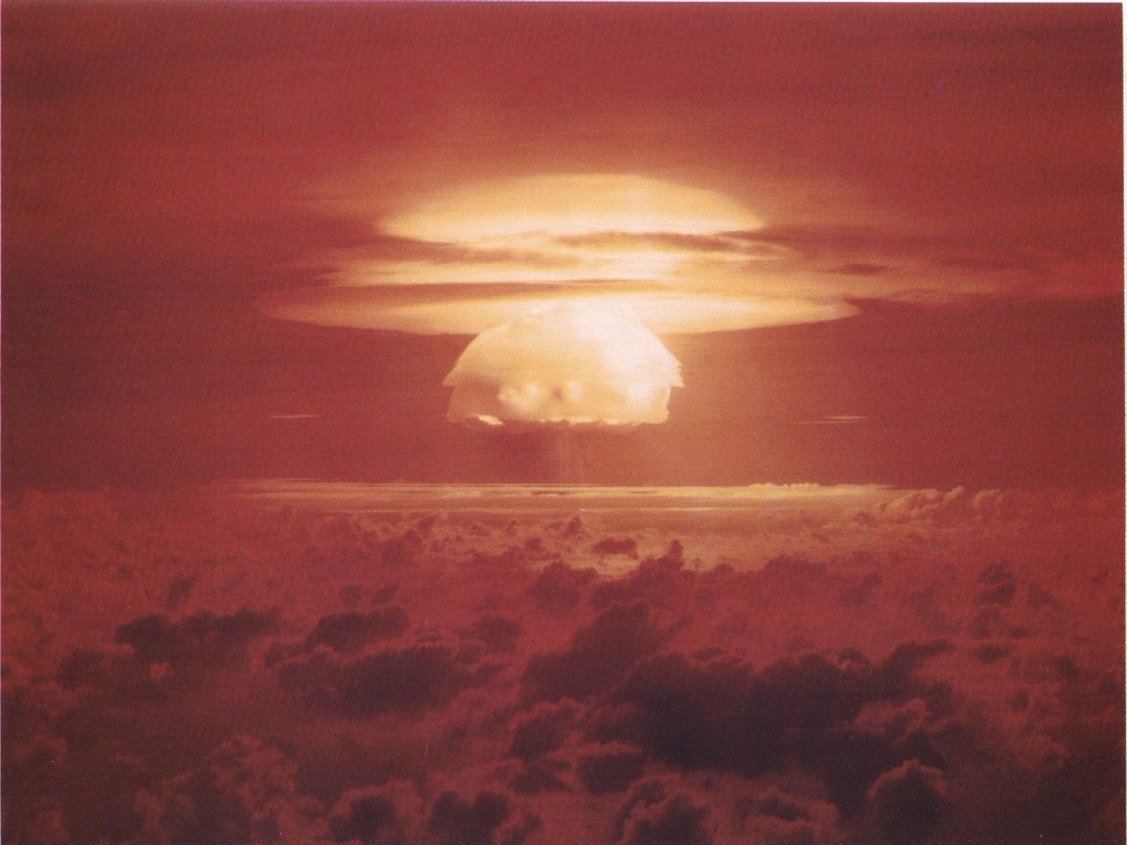
event was an experimental thermonuclear device surface event. - United States Department of Energy Castle Bravo was the first in a series
of high-yield thermonuclear weapon design tests conducted by the United
States at Bikini Atoll, Marshall Islands, as part of Operation Castle.
Detonated on March 1, 1954, the device was the most powerful nuclear
device detonated by the United States and its first
lithium-deuteride-fueled thermonuclear weapon. Castle Bravo's
yield was 15 megatons of TNT, 2.5 times the predicted 6 megatons, due
to unforeseen additional reactions involving 7Li, which led to the
unexpected radioactive contamination of areas to the east of Bikini
Atoll.
Fallout from the detonation fell on residents of Rongelap and Utirik atolls and spread around the world. The islanders were not evacuated until three days later and suffered radiation sickness. Twenty-three crew members of the Japanese fishing vessel Daigo Fukuryū Maru ("Lucky Dragon No. 5") were also contaminated by fallout, experiencing acute radiation syndrome. The blast incited international reaction over atmospheric thermonuclear testing. The Bravo Crater is located at 11°41′50″N 165°16′19″E. The remains of the Castle Bravo causeway are at 11°42′6″N 165°17′7″E.
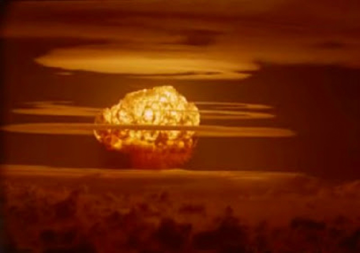
showing multiple condensation rings. - AtomCentral |
||
| Related Links: |
||
| FAIR USE NOTICE: This page contains copyrighted material the use of which has not been specifically authorized by the copyright owner. Pegasus Research Consortium distributes this material without profit to those who have expressed a prior interest in receiving the included information for research and educational purposes. We believe this constitutes a fair use of any such copyrighted material as provided for in 17 U.S.C § 107. If you wish to use copyrighted material from this site for purposes of your own that go beyond fair use, you must obtain permission from the copyright owner. | ||
|
|