|
|
|||
|
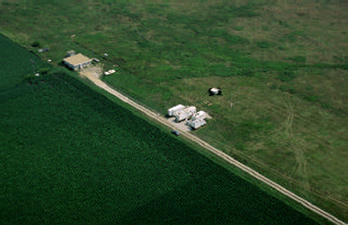
Flatland Atmospheric Observatory Bondville Field Station Champaign–Urbana, Illinois +40° 2' 57.00", -88° 22' 51.00" ..
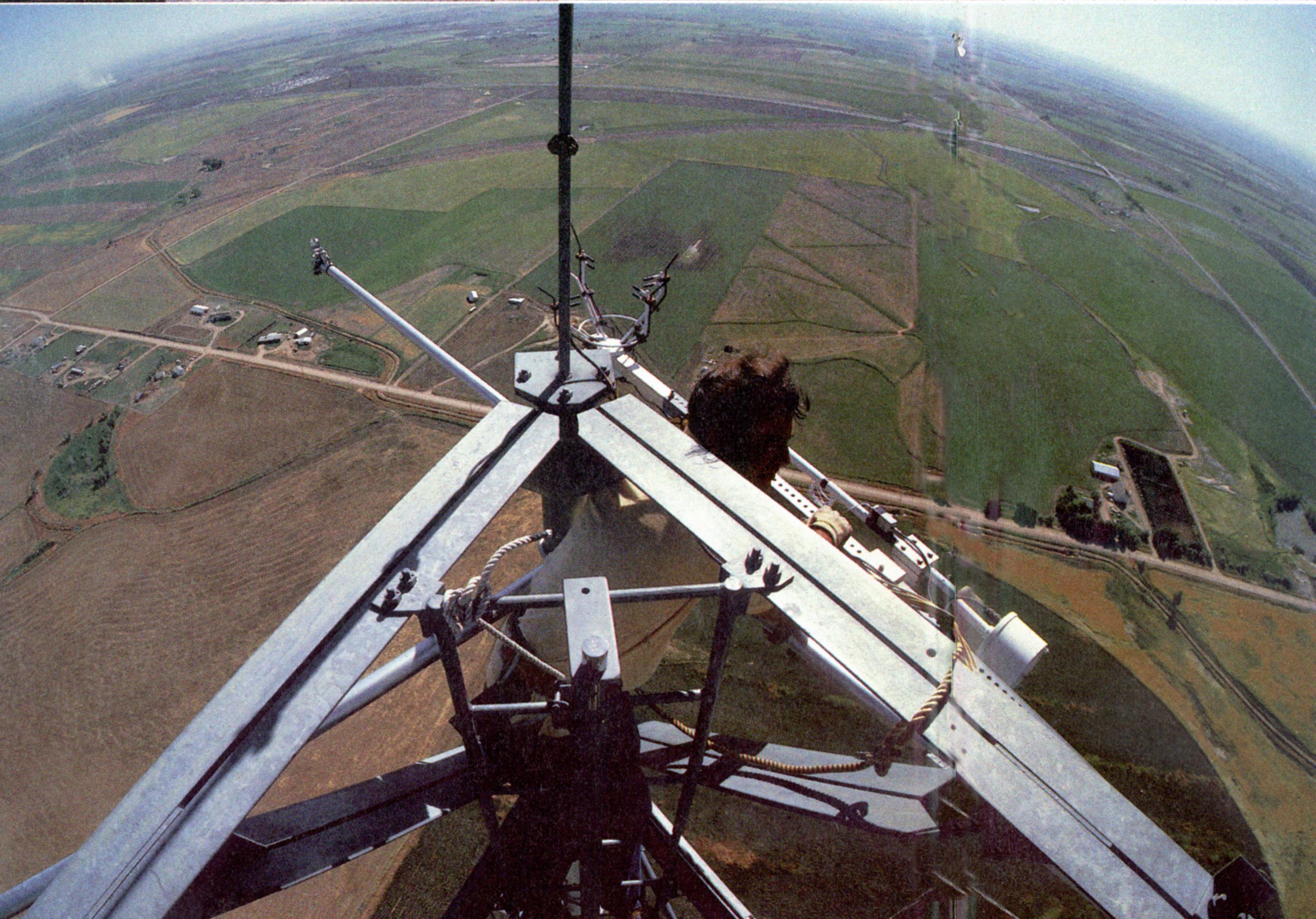
The Flatland Atmospheric Observatory
is operated by the University of Illinois (Champaign-Urbana). The barely-visible
grid in the grass to the left of the end of the road in the middle of the
circle is a vertically-pointing radar array that is used to measure the
wind at various levels up to the stratosphere.
Flatland Atmospheric Observatory
Abstract: The Aeronomy Lab of NOAA/ERL maintains the Flatland Atmospheric Observatory (FAO) at the Bondville Field station of the University of Illinois at Urbana-Champaign. The region is one of the flattest in the continental United States, and is far removed from mountains, particularly in the direction of the prevailing wind. In the mountains, orographic effects dominate other dynamical effects. The purpose of the FAO is to study atmospheric dynamics in an area where orographic effects are minimal. The FAO contains a suite of instruments to identify and scale the important atmospheric dynamical processes. These include a very-high frequency (VHF) and an ultra-high frequency (UHF) Doppler wind profiler, a radio acoustic sounding system (RASS), a network of barometers, a surface meteorological station with various sensors, and a radiosonde balloon receiving system. This suite of instruments can measure height profiles of wind, its spectra, the vertical flux of horizontal momentum throughout the troposphere and lower stratosphere, profiles of temperature, its spectra, and heat flux in the boundary layer, and the wavelength, amplitude, speed and direction of surface pressure waves passing through the barometer network. The instruments can make these measurements over a range of scales -- from that of internal waves to longer than synoptic scales. The OAR0151 data set contains raw and processed data from the VHF (49.8 MHz) Doppler wind profiler. The radar first became operational in March 1987 with one antenna beam pointing vertically. Since June 1990, the antenna system consists of two collocated and steerable antennas; one steerable in the north-south plane, and the other in the east-west plane. The data set consists of 3 Gbytes of processed data and 200 Gbytes of raw data. This OAR0152 data set contains data from the FAO's mesoscale digital barometer network. The network was installed in November 1990. Initially, five barometers were positioned at roughly equal intervals in a ring about the FAO with a radius of approximately 25 km, and with a sixth barometer at FAO. In January 1992, a seventh barometer was installed in southern Urbana about 12 km from FAO. According to the manufacturer's specifications, the absolute pressure of the barometer measurements is accurate over a year to +/- 0.25 hPa; tests show that the relative accuracy is about five times better over short periods of time. Currently, the barometers are sampled every 10 seconds, and the samples are averaged over two minutes. These averages are recorded at the site, and then downloaded nightly to the Aeronomy Laboratory, in Boulder Colorado, where they are archived and analyzed. The data set consists of 500 Mbytes of data. This OAR0153 data set contains data from the Flatland UHF radar. The system was installed in October 1991 to supplement the VHF radar. Initially, the UHF radar consisted of one fixed vertically pointing antenna beam. In early 1993, the system was upgraded to a five beam wind profiler oriented parallel to the VHF radar. The UHF radar extends the wind observations and, therefore, also the vertical flux of horizontal momentum measurements to lower heights (to about 100 m) with better height resolution (100 m). Further, because a UHF radar is much more sensitive to hydrometeors than the VHF radar, studies utilizing the different reflection strengths of hydrometeors between the two frequencies are possible. The OAR0154 data set contains data from the RASS system. The RASS system was installed to operate with the radar systems in October 1991. It measures the virtual temperature and heat flux profiles in the boundary layer. The data set consists of 1 Gbyte of data. The OAR0155 data set contains
height profiles of pressure, temperature, and humidity collected
by radiosondes with a seven-meter height resolution, from the surface to
about 20 km. A radiosonde balloon receiving system was installed at the
site in January 1991 for use in special campaigns. Since the radiosondes
are used for only a
A flexible computer based data processing and control system allows mixing of radar resolution, sampling volumes, antenna beam selection, and other processing parameters for a flexible sampling strategy. The sampling strategy typically used results in a great deal of redundancy in profiling winds, allowing consistency checks to be applied to the data. Supplemental Information: Reference: Warnock, J. M., et al., "The Flatland Atmospheric Observatory: Statusand Case Study," Eigth Symposium on Meteorological Observations and Instrumentation, (published by: American Meteorlogical Society, Boston), 1993. Sources: GROUND STATIONS Sensors: BAROMETERS
|
|||
|
Bondville Field Station Champaign–Urbana, Illinois +40° 2' 57.00", -88° 22' 51.00" Update 2009 ....
..
..
|
|||
| Flatland Boundary Layer Experiments
ABSTRACT This article describes the 1995 and 1996 Flatland boundary layer experiments, known as Flatland95 and Flatland96. A number of scientific and instrumental objectives were organized around the central theme of characterization of the convective boundary layer, especially the boundary layer top and entrainment zone. In this article the authors describe the objectives and physical setting of the experiments, which took place in the area near the Flatland Atmospheric Observatory, near Champaign–Urbana, Illinois, in August–September 1995 and June–August 1996. The site is interesting because it is extremely flat, has uniform land use, and is in a prime agricultural area. The instruments used and their performance are also discussed. The primary instruments were a triangle of UHF wind-profiling radars. Rawinsondes and surface meteorological and flux instruments were also included. Finally, some early results in terms of statistics and several case studies are presented. |
|||
| Flatland Observatory Project
II
Flatland Observatory Project II. This was the second year for this boundary-layer structure and dynamics experiment. The basic intensive observation period ran from 15 June through 15 August 1996, but was extended to the middle of September to support the Lidars in Flat Terrain (LIFT) experiment (see LIFT below for details). The primary focus for this year's experiment was to study boundary-layer height, divergence, entrainment velocity, and entrainment processes, as well as measurements of the atmospheric heat-budget terms. Two ISS stations were deployed in a triangular array with the NOAA 915-MHZ wind profiler that is permanently located at the Flatland Atmospheric Observatory (FAO). This year, three flux-measuring (Flux-PAM) versions of the SSSF Portable Automated Mesonet (PAM-III) stations were added to the experiment as "anchors" for the boundary-layer measurements from the ISS and the FAO instruments. The Flux-PAMs provided flux measurements over typical crops (corn and soybeans) found in the experimental area. In addition to the standard meteorological measurements of wind, pressure, temperature, humidity, and rainfall, the Flux-PAM stations made measurements of soil temperature and moisture, as well as flux measurements of latent heat, momentum, and radiation. Flux measurements of ozone surface deposition were also made for the last thirty days of the experiment. At one site the Flux-PAM was enhanced with components of the ASTER system (64 Kb) in order to better acquire and process the fast data for the ozone surface deposition fluxes. |
|||
|
..
The LIFT dataset includes measurements from several instruments located at a site near the Flatland Atmospheric Observatory outside Urbana, Illinois. Boundary
Layer Height Determination With the LIFT Dataset
Lidars in Flat Terrain (LIFT). SSSF also participated in the LIFT experiment, which was closely linked with the Flatland Observatory Project II in central Illinois. In addition to the two ISS (57Kb) and three Flux-PAM stations deployed for Flatland, SSSF installed ATD's Staring Aerosol Backscatter Lidar (SABL, 106KB) and one enhanced Flux-PAM for ozone flux measurements at one of the ISS sites. Other LIFT instrumentation included NOAA/ETL's 2-micron High-Resolution Doppler Lidar (HRDL) and the Ozone Differential Absorption Lidar (DIAL). LIFT's objective was to study the high-resolution structure of winds, aerosol, and ozone as the daytime boundary layer grows and decays. The data gathered during the four-week experiment will also be used to evaluate lidar and profiler techniques for quantifying fluxes, turbulence, and boundary-layer height. |
|||
| FAIR USE NOTICE: This page contains copyrighted material the use of which has not been specifically authorized by the copyright owner. Pegasus Research Consortium distributes this material without profit to those who have expressed a prior interest in receiving the included information for research and educational purposes. We believe this constitutes a fair use of any such copyrighted material as provided for in 17 U.S.C § 107. If you wish to use copyrighted material from this site for purposes of your own that go beyond fair use, you must obtain permission from the copyright owner. | |||
|
|