|
European Incoherent Scatter Scientific Association |
|||||||
|
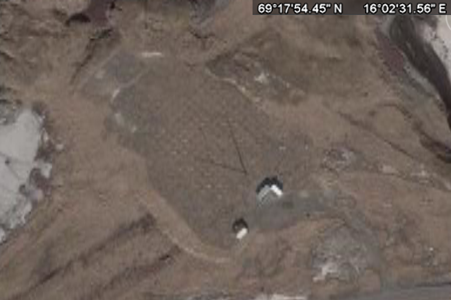
Andøya, Norway +69° 17' 54.41", +16° 2' 31.48" ..
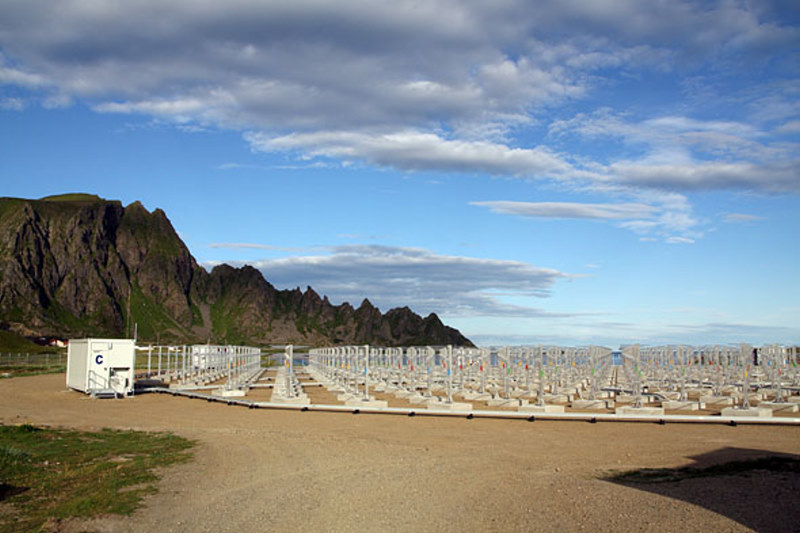
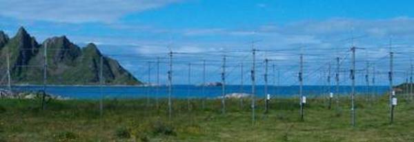
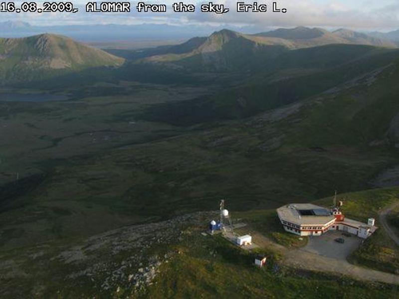
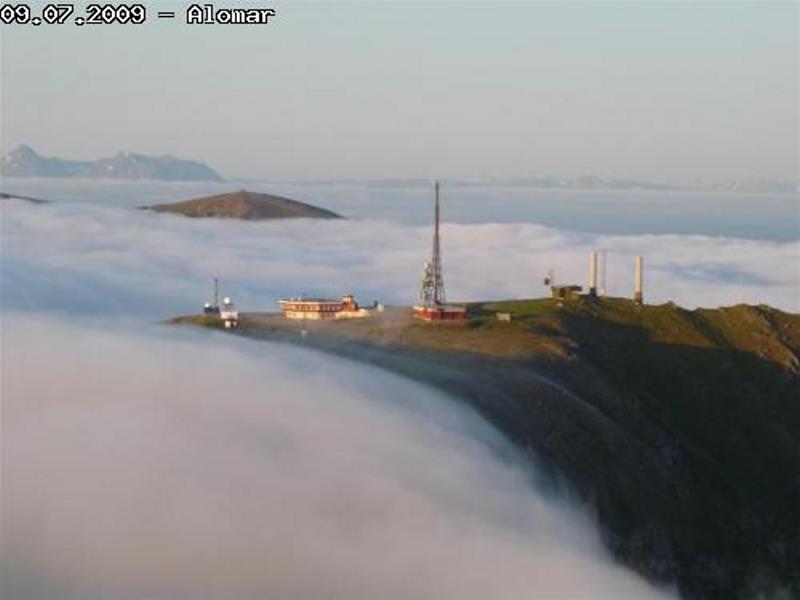
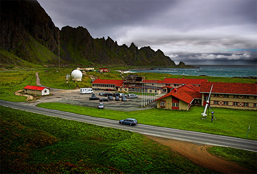
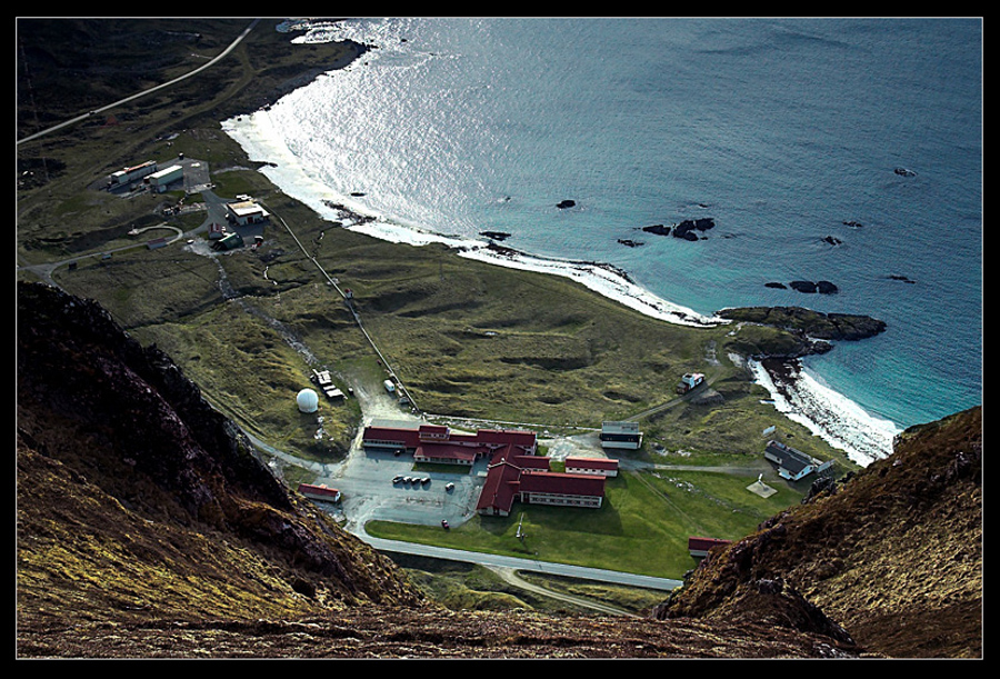
The view of the radar towards ARR (photo: K. Dahle) The Leibniz-Institute of Atmospheric Physics in Kühlungsborn, Germany (IAP) is installing a new powerful VHF radar on the North-Norwegian island Andøya (69.30°N, 16.04°E) in 2009. The new radar replaces the existing ALWIN radar which has been operated continuously on Andøya for more than 10 years. The goal of the new system is the investigation of horizontal structures of Polar Mesosphere Summer Echoes (PMSE) caused by mesospheric ice clouds. Three-dimensional structures of the wind field and turbulent parameters determined from the radar data will be used to compare the detected PMSE distribution in detail with wind and turbulence variations caused by wave activity. The new ALWIN radar is a monostatic radar with an active phased array antenna. Its operational frequency is 53.5 MHz and the maximum peak power is approximately 800 kW. The system is composed of an active phased array antenna designed by IAP consisting of 433 Yagi antennas and an identical number of transceiver modules. The radar hardware is designed and manufactured by Genesis Software Pty Ltd. The nearly circular array with a diameter of approximately 90 m corresponding to an aperture of ~6300m2 results in a very symmetric antenna radiation pattern with a half power beam width of 3.6°, a directive gain of 33.5 dBi and an almost symmetric first side lobe with more than 17 dB suppression with respect to the main lobe. The new ALWIN radar will start with a 16-channel data acquisition system with 25 meter sampling resolution and 16-bit digitization specified which will be upgraded to 64 channels in the final stage. The high flexibility of the new system allows classical Doppler beam swinging as well as experiments with simultaneously formed multiple beams and the use of modern interferometric applications for improved studies of the Arctic atmosphere from the troposphere up to the lower thermosphere with high spatiotemporal resolution. The installation of the antenna array will be finished in the first week of August 2009. The radar control and data acquisition hardware as well as 145 transceiver modules will be installed in September 2009. The initial expansion stage will use an antenna beam with a beam width comparable to the old ALWIN system but with symmetrical side lobes and free beam steering capability. The second expansion stage is scheduled for spring 2010 with the goal to observe the upcoming PMSE season with full power. SOURCE: Andøya Rocket Range Andøya Rocket Range, PO Box 54,
.. |
|||||||
Related Links:
|
|||||||
|
+69° 17' 54.41", +16° 2' 31.48" ..
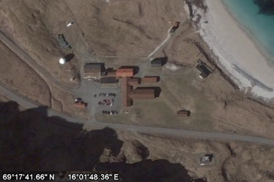
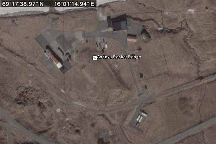
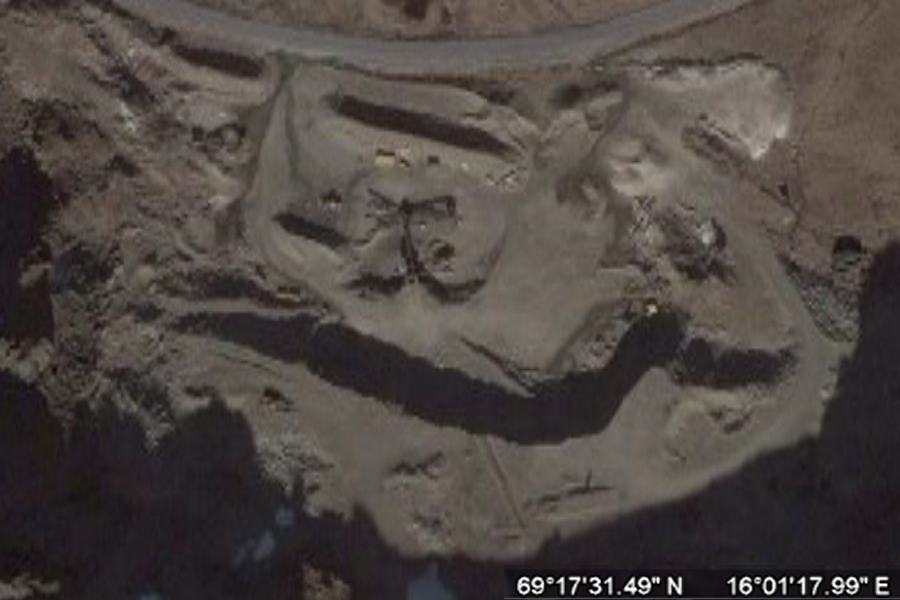
Andøya Rocket Range Andøya Rocket Range is a rocket launch site and rocket
range on Andøya island (the northernmost in the Vesterålen archipelago)
in Andøy municipality in northern Norway. Since 1962 over 1,200 sounding
rockets of all known configurations have been launched from this site.
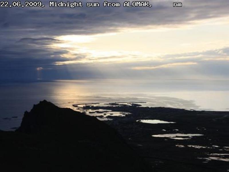
Andøya Rocket Range is a civilian facility owned 90% by the Royal Ministry of Trade and Industry, Norway, and 10% by Kongsberg Defence & Aerospace. It operates on a commercial basis. From 1997, a second launch site at Ny-Ålesund, Svalbard was established, enabling scientists to launch sounding rocket straight in the polar cusp. A ground based lidar observatory, ALOMAR (Arctic Lidar Observatory for Middle Atmosphere Research) opened in 1994, and is considered unique in atmospheric research in the Arctic. The range is also host of northern Europe's largest MF-radar. Andøya Rocket Range has also been involved in building Norway's first student satellites, the nCube-series (*nCube website), and hosts a number of student activities like the European Space Camp organized by the Norwegian Association of Young Scientists and The Norwegian Centre for Space Related Education. In 1995, a rocket from Andøya caused high alert in Russia. They thought it might be a nuclear missile launched from a submarine. President Boris Yeltsin was alerted for a possible counter strike, when the Russians understood that it was not heading towards Russia. There were press photos all over the world of Yeltsin with the launch command briefcase. The Russians were informed in advance about the launch, but this information was lost in the Russian military organization. SOURCE: Wikipedia Andøya Rocket Range
..
..
..
..
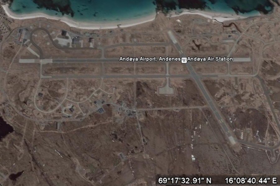
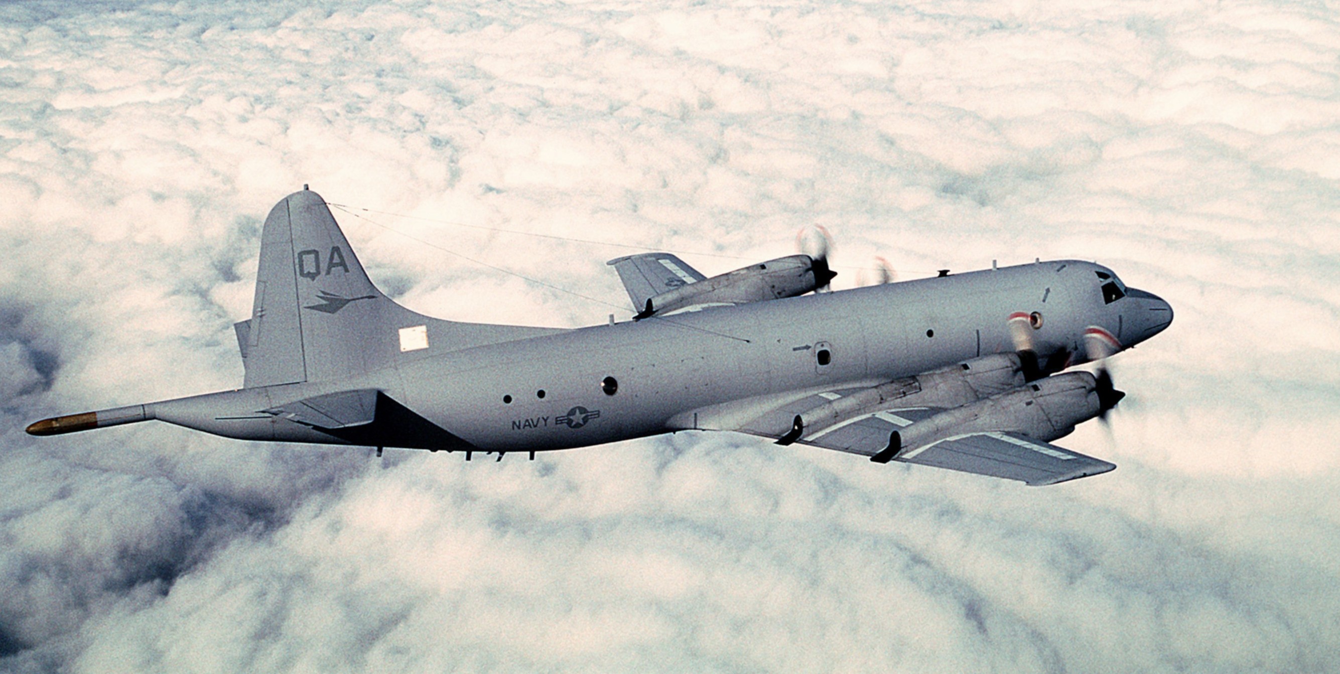
Andøya Air Station (IATA: ANX, ICAO: ENAN) (Norwegian:
Andøya Flystasjon) is situated in the north of Norway, in the municipality
of Andøy. At Andøya, the 333 Squadron is based with P-3C Orions. The
squadron is Norway's only surveillance squadron and stands as the airborne
defence of northern Norway. Andøya Air Station is designed to handle fighters
and should it become necessary, fighter squadrons can be deployed to protect
this region. Squadron 333 is the only Norwegian squadron still in operation
after its initial deployment.
The civil airport Andøya Airport, Andenes and the civilian sounding rocket launch facility Andøya Rocket Range is also located on the island. The six Orion aircraft primary function is surveillance, mostly in the north and for both military and civilian functions. The planes are also the only that can help ship wrecked far from land. The aircraft also have a lot of cooperation with the Norwegian Coast Guard. History The first idea of building a military airport was launched at a NATO meeting in Lisbon in 1951. In March 1952 the Norwegian Minister of Defence, Nils Langhelle announced that the airport was going to be build. There were multiple suggested locations, and the decision fell on the village Haugnes. The entire village with 310 residents was expropriated to give enough area for the airport. The community at Andøy only had 2000 residents at the time, and a large growth was expected. The first aircraft landing was on September 17, 1954, Douglas Dakota. The air station was operational from the fall 1957. The headquarters were located about 13 km away at Skarsteindalen, as part of NATOs spread tactic. In 1961 the first squadron, the 333, was moved to the air station, from Sola Air Station, with HU-16B Albatross aircraft. After a bit civilian services were wanted, and April 2, 1964 the first schedules flight was flown by Scandinavian Airlines with a Metropolitan. In 1968 the second runway was finished. In the 1970s the airport became part of the new network of regional airports in Lofoten and Vesterålen with government subsidised operations with de Havilland DHC-6 Twin Otter aircraft seating 20 and operated by Widerøe. The Albatrosses were replaced in 1969 with P-3B Orion
aircraft. Though they lacked the ability to perform work for the Coast
Guard and in 1989 they were sold to Spain and replaced with new P-3C aircraft.
After the end of the Cold War in the 1990s the air station has been reduced.
|
|||||||
|
Andøya, Norway +69° 17' 54.41", +16° 2' 31.48" ..
..
..
..
.. |
|||||||
|
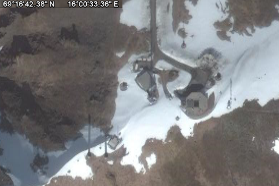
Andøya, Norway +69° 17' 54.41", +16° 2' 31.48" ..
Andøya Rocket Range (ARR) is a limited, ISO 9001:2000 certified company owned 90% by the Norwegian Department of Trade and Industry, and 10% by Kongsberg Defence & Aerospace. ARR supports sounding rocket and balloon operations both from Andøya and Svalbard. The client list includes ESA, NASA, JAXA as well as hundreds of universities and research institutions worldwide. ARR is located on the Norwegian island Andøya, 2 degrees north of the Arctic Circle. Andøya has its own airport capable of handling all sizes of aircrafts. Several daily connections to Oslo makes it convenient getting to and from the island. SOURCE: Andøya Rocket Range
..
.. |
|||||||
Andøya Aurora ..
A very bright aurora last night! ..
The sky above Frankfurt Airport - a BUSY place to be! ..
..
|
|||||||
|
Imaging Riometer for Ionospheric Studies - AIRIS +69° 8' 45.60", +16° 1' 44.40" ..
The ALOMAR Observatory (Andøya Rocket Range) has in 2002 started the process of building an imaging riometer at Andøya in cooperation with the (Riometer) Lancaster University in England, UK and (Array) Genesis Software Pty Ltd in Australia. The system has, except for a newer technology in most areas the same basic features as the existing Imaging Riometer for Ionospheric Studies (IRIS) system installed in Northern Finland, installed by the Lancaster Ionosphere and Radio Propagation Group. The new AIRIS system has a sophisticated phased array antenna which produces 49 narrow beams, of the order of 12 degrees beam width. The riometer outputs are all sampled once per second. The AIRIS system is capable of examining ionospheric electron density perturbations in both small time scale (1 second), as well as small spatial scale (approx. 20 km). This enables the structure and dynamics of the energetic particle precipitation over a large field of view to be determined with a spatial resolution, which is not at presently obtainable with any other technique. Preliminary data from the new Imaging riometer is available on-line at all time. The research topics employing the AIRIS system include:
The AIRIS is a part of the Global Riometer Array (Gloria) which is an international collaborative program for scientific investigation of the role of particle precipitation in the sun-earth connection. In partucular it aims at an improved understanding of the coupling mechanism between the solar wind, magnetsophere and the ionosphere. There are currently over 20 imaging riometer arrays worldwide. AIRIS Technical data:
..
SOURCE: Andøya Rocket Range Related Links: |
|||||||
| FAIR USE NOTICE: This page contains copyrighted material the use of which has not been specifically authorized by the copyright owner. Pegasus Research Consortium distributes this material without profit to those who have expressed a prior interest in receiving the included information for research and educational purposes. We believe this constitutes a fair use of any such copyrighted material as provided for in 17 U.S.C § 107. If you wish to use copyrighted material from this site for purposes of your own that go beyond fair use, you must obtain permission from the copyright owner. | |||||||
|
|