|
|
||||||||||
|
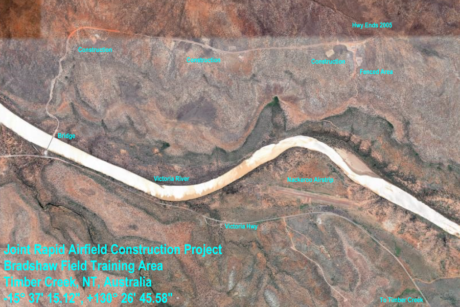
Bradshaw Field Training Area Timber Creek, NT, Australia -15° 37' 15.12", +130° 26' 45.58" ..
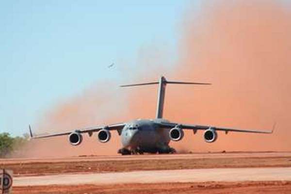
C-17 Globemaster aircraft at Bradshaw Field Training Area (BFTA) Joint Rapid
Airfield Construction
Project
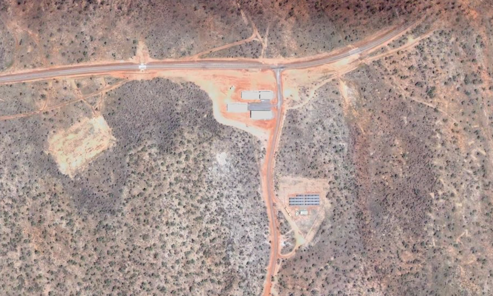
A team of Australian and United States military engineers has successfully built an air strip in less than four weeks capable of taking the giant C-17 Globemaster aircraft at Bradshaw Field Training Area (BFTA) in the Northern Territory. The Joint Rapid Airfield Construction (JRAC) project team used technologies such as remote control plant equipment, GPS location software and deployable communication systems to build the unsealed landing strip and service aprons. Construction began on 3 June. The Australian Chief of Air Force, Air Marshal Geoff Shepherd joined Commander of the US 7th Fleet, Vice Admiral Doug Crowder at BFTA for today's official opening of the airstrip, in which Australian and American C-17s gave the strip its first major test. "The ADF is still developing Bradshaw Field Training Area, and an airstrip which can accommodate Australia's newly acquired C-17s is a major boost for the facilities here," Air Marshal Shepherd said. "The airfield has now been certified and will be available for future training activities and exercises involving Australian personnel," Air Marshal Shepherd said. The exercise has involved 110 Australian personnel and 105 US personnel. Another 20 civilians from US Army Corp's of Engineers Engineer Research Development Centre have also been involved in the exercise. This airfield is an example of the type of construction that either United States or Australian engineers would need to undertake to expand a forward base for strategic or heavy lift air transport. This design provides unloading aprons for two C-17 aircraft with a third aircraft on the runway. |
||||||||||
| PROJECT
DESCRIPTION
The Joint Rapid Airfield Construction (JRAC) 2007 Demonstration Project involves the design and construction of a C-130 and C-17 capable Assault Landing Zone (ALZ) at Bradshaw Field Training Area (BFTA) in Northern Territory, Australia. The purpose of this project is to: (1) demonstrate the technologies developed under the JRAC program and (2) provide BFTA with a facility to accommodate C-17 and C- 130 aircraft operations in order to improve the training effectiveness of the range.
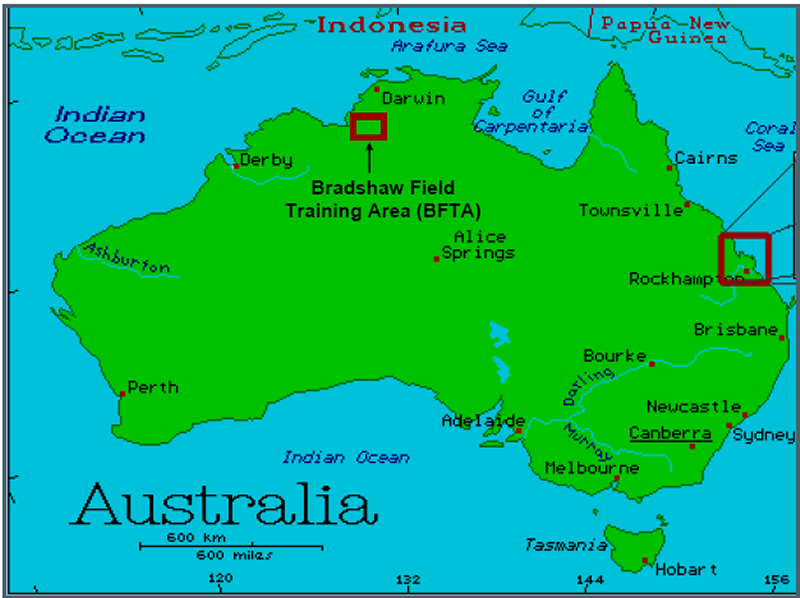
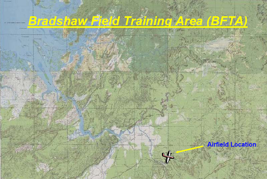
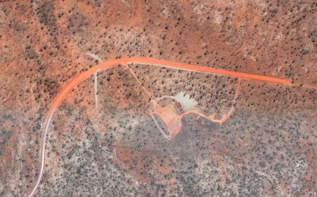
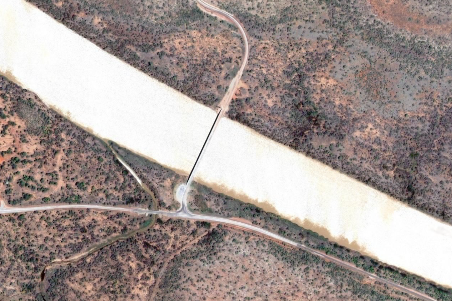
Location of Bradshaw Field Training Area The project will be designed in accordance with the criteria prescribed in ETL 04-07 and ETL 97-9 to meet the requirements of C-17 and C-130 aircraft. The airfield will be constructed using the equipment, tools, techniques, and methods developed under the JRAC program. The airfield will be 4100 ft (1250 m) in length, have a minimum maximum on ground (MOG) 1 apron, and will have a semi-prepared surface consisting of aggregate material obtained from local borrow sites. Bradshaw ALZ will be structurally designed to accommodate 500 passes of a C-17 aircraft and will be designed in a manner to maximize the durability of the airfield, minimize the maintenance requirements, and allow for future improvements or upgrades (e.g. sealing of the surface). The airfield will be constructed using military construction equipment from the Australian military and US military in a manner consistent with how this type of construction would be accomplished in a contingency environment. Bradshaw Field Training Area (BFTA) is located near Timber Creek within the Victoria River Region of the Northern Territory, approximately 600km by road southwest of Darwin. Situated at the southwestern extremity of the Top End (Figure 1), the region is subject to the summer monsoon or wet season from October to April, the dry season from May to September and periods of transition in between.
Location of Proposed Airfield SOURCE: Joint Rapid Airfield Construction (JRAC) 2007 Demonstration Project |
||||||||||
|
Timber Creek, NT, Australia -15° 37' 15.12", +130° 26' 45.58" ..
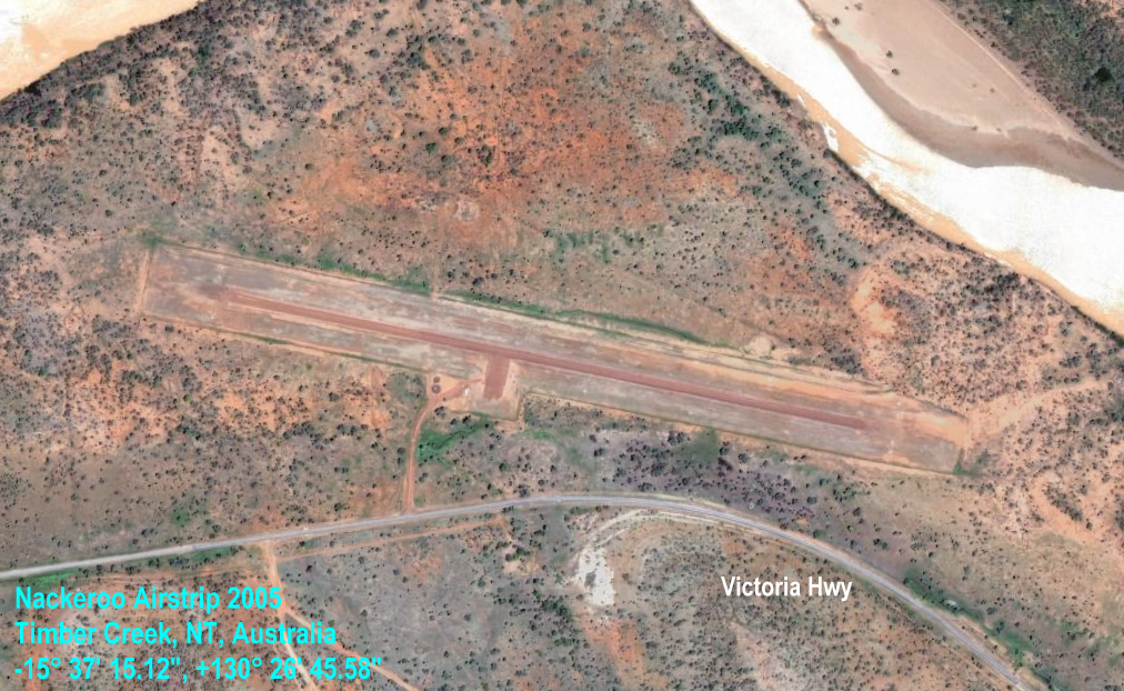
Nackeroo
Airstrip
Nackeroo LZ was offically christened with a RAAF C-130 operation on the morning of June 23, 2007. The US Air Force certification crew gave their official blessing for C-130 ops and the Royal Australian Air Force responded with quite a show for the construction team. The airfield was proudly named after the famous North Australian Observation Unit (NAUO), nicknamed the "Nackeroos" that patrolled the Northern Territory in WWII. Based in Katherine, NT (about 250 km east of Timber Creek) and led by a former anthropologist familiar with the area, Maj. William Stanner, the Nackeroos gained quite a reputation for their toughness and dedication. Initially struggling in this harsh territory, the Nackeroos formed strong alliances and gained respect for the Aboriginal inhabitants that helped them navigate the area and survive. The cooperation and mutual respect continues today as evidenced by the cooperation that is Bradshaw Field Training Area. |
||||||||||
|
Bradshaw Field Training Area Timber Creek, NT, Australia -15° 37' 15.12", +130° 26' 45.58" ..
..
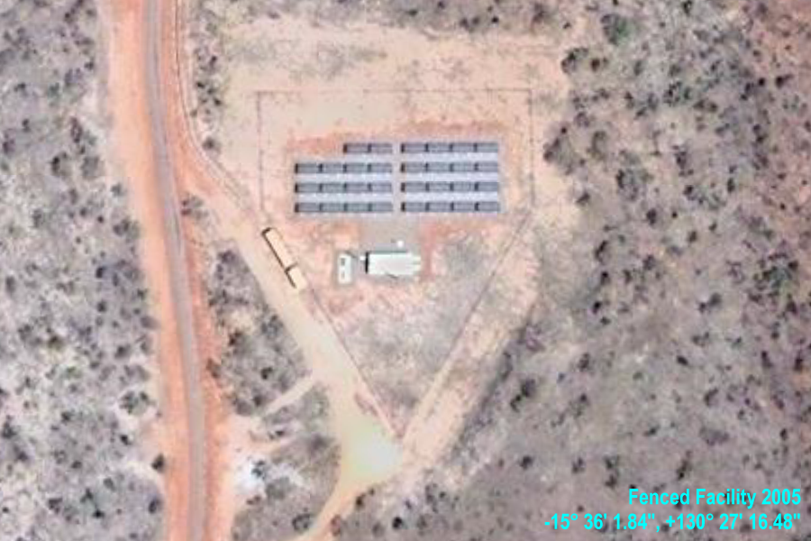
-15° 36' 1.84", +130° 27' 16.48" By tegandrew Australian
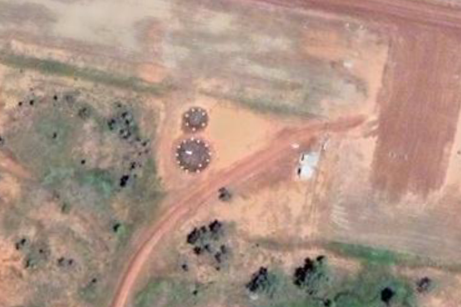
Renewable Energy Generators
-15° 35' 50.46", +130° 25' 31.04" ..
-15° 35' 50.08", +130° 27' 23.90" ..
-15° 35' 52.84", +130° 27' 14.48" ..
-15° 35' 50.83", +130° 24' 53.19" ..
-15° 35' 51.64", +130° 25' 53.98" ..
..
-15° 36' 45.73", +130° 24' 29.01" ..
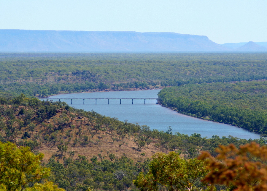
From Escarpment Lookout By Peter Connolly |
||||||||||
Related Links:
Joint Rapid Airfield Construction (JRAC) 2007 Demonstration Project. Bradshaw Field Training Area (BFTA), Northern Territory, Australia. U.S.Army Corps of Engineers - PDF |
||||||||||
| FAIR USE NOTICE: This page contains copyrighted material the use of which has not been specifically authorized by the copyright owner. Pegasus Research Consortium distributes this material without profit to those who have expressed a prior interest in receiving the included information for research and educational purposes. We believe this constitutes a fair use of any such copyrighted material as provided for in 17 U.S.C § 107. If you wish to use copyrighted material from this site for purposes of your own that go beyond fair use, you must obtain permission from the copyright owner. | ||||||||||
|
|