|
|
||||||||||||||||||||||||||||||||||
|
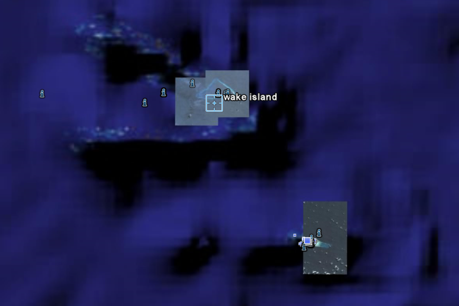
+6° 22' 58.91", -162° 21' 46.78" ..
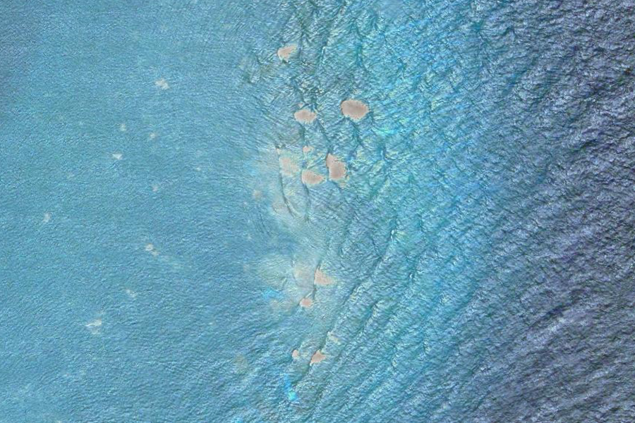
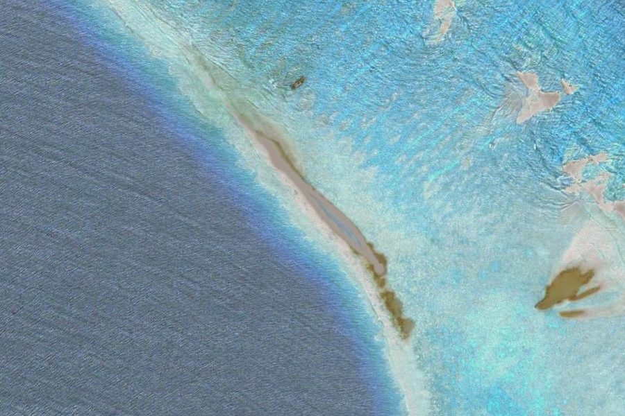
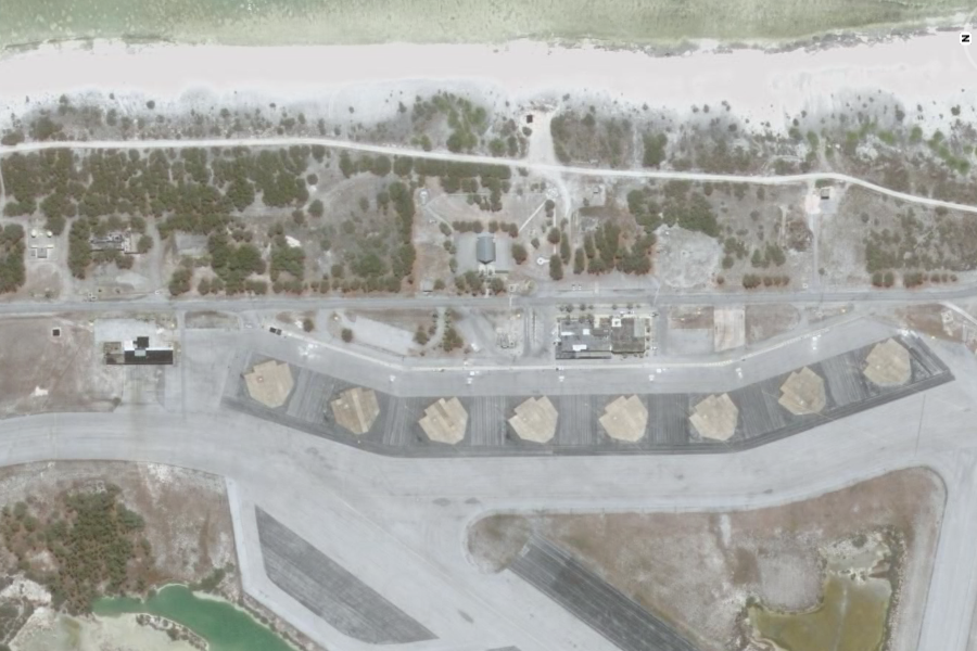
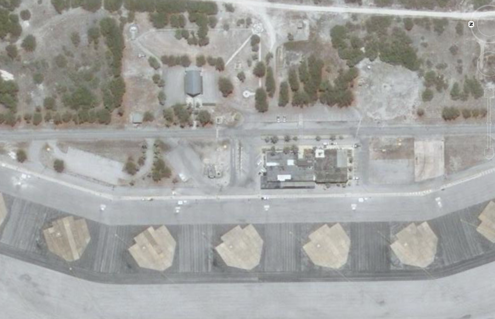
Go to Google Earth and type in Wake Island... the above image is what you will see... map generated coordinates are given as +6° 22' 58.91", -162° 21' 46.78" Go to google and search for Wake Island... you will first see the following image
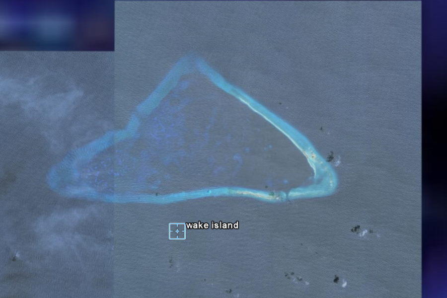
Okay they match... and here are some close ups...
..
..
..
..
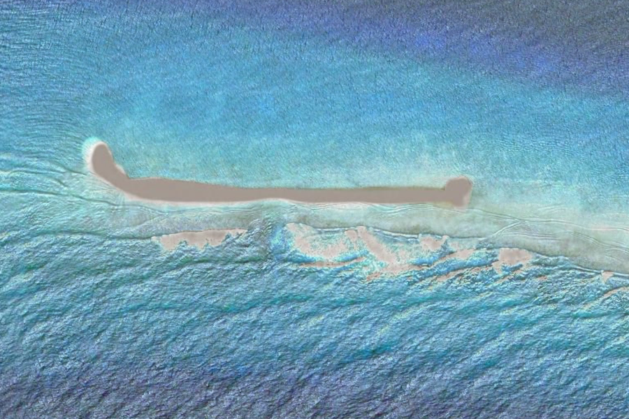
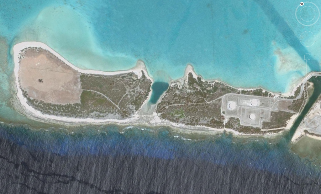
Well how about that! Seems they don't want you to see what is going on on Wake Island But WAIT! There is more... Anyone who ever flew in the Pacific War , like John Lear, will tell you... This is NOT Wake Island... not
THE Wake Island anyway..
|
||||||||||||||||||||||||||||||||||
|
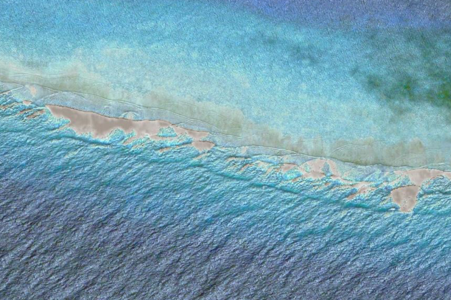
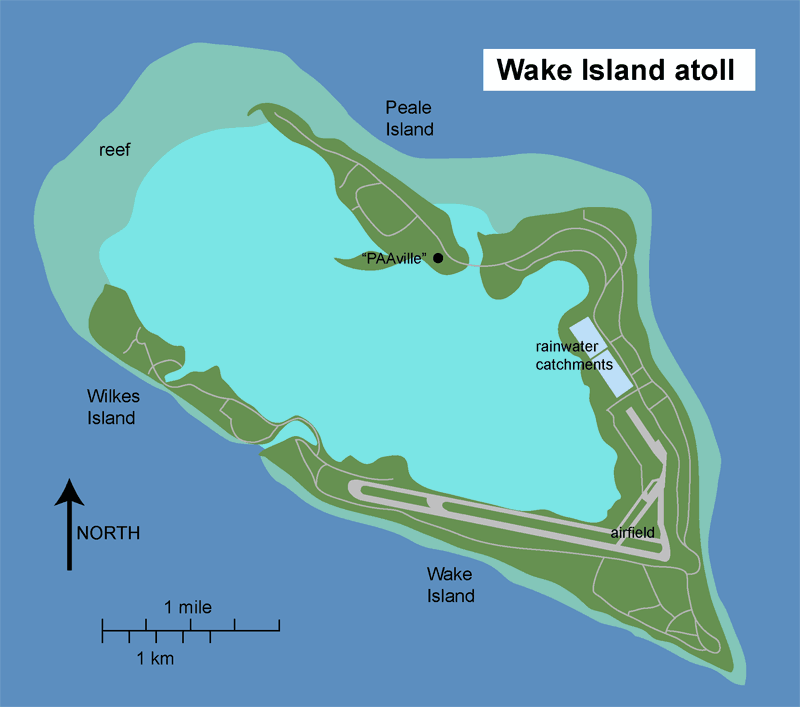
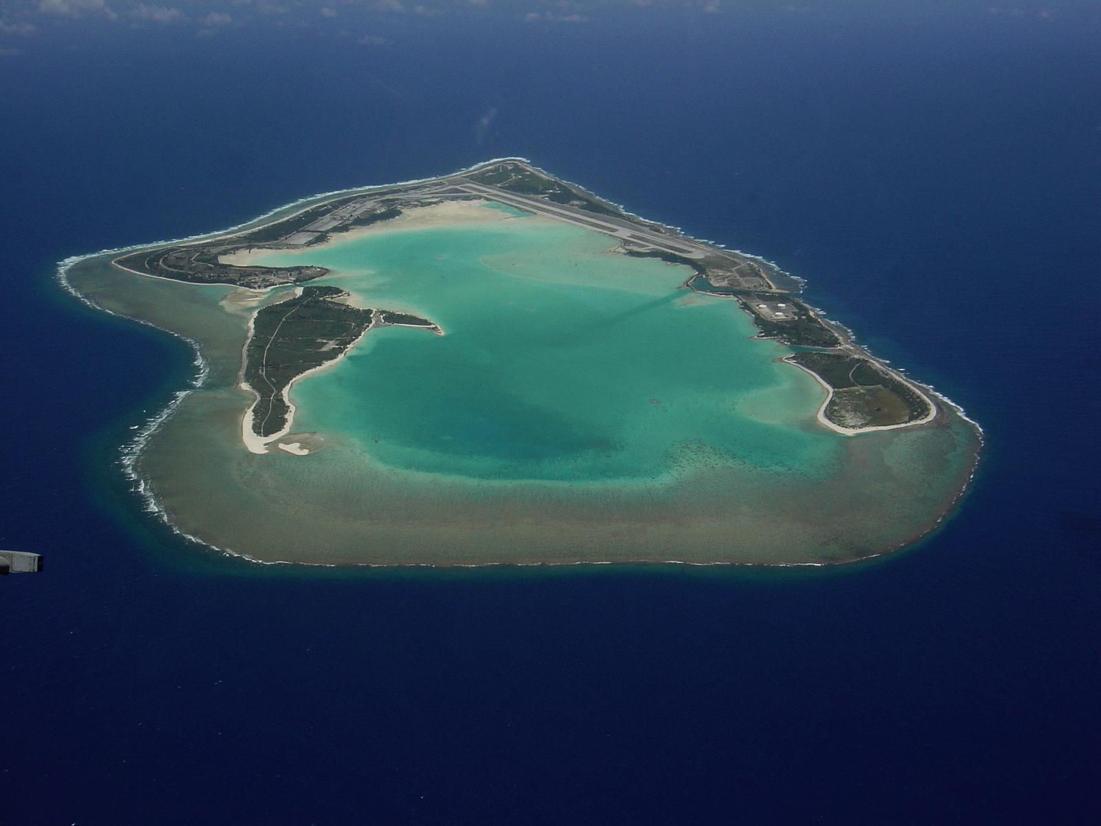
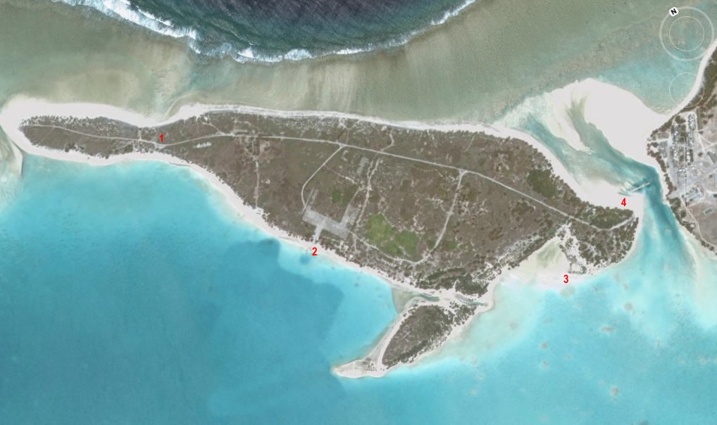
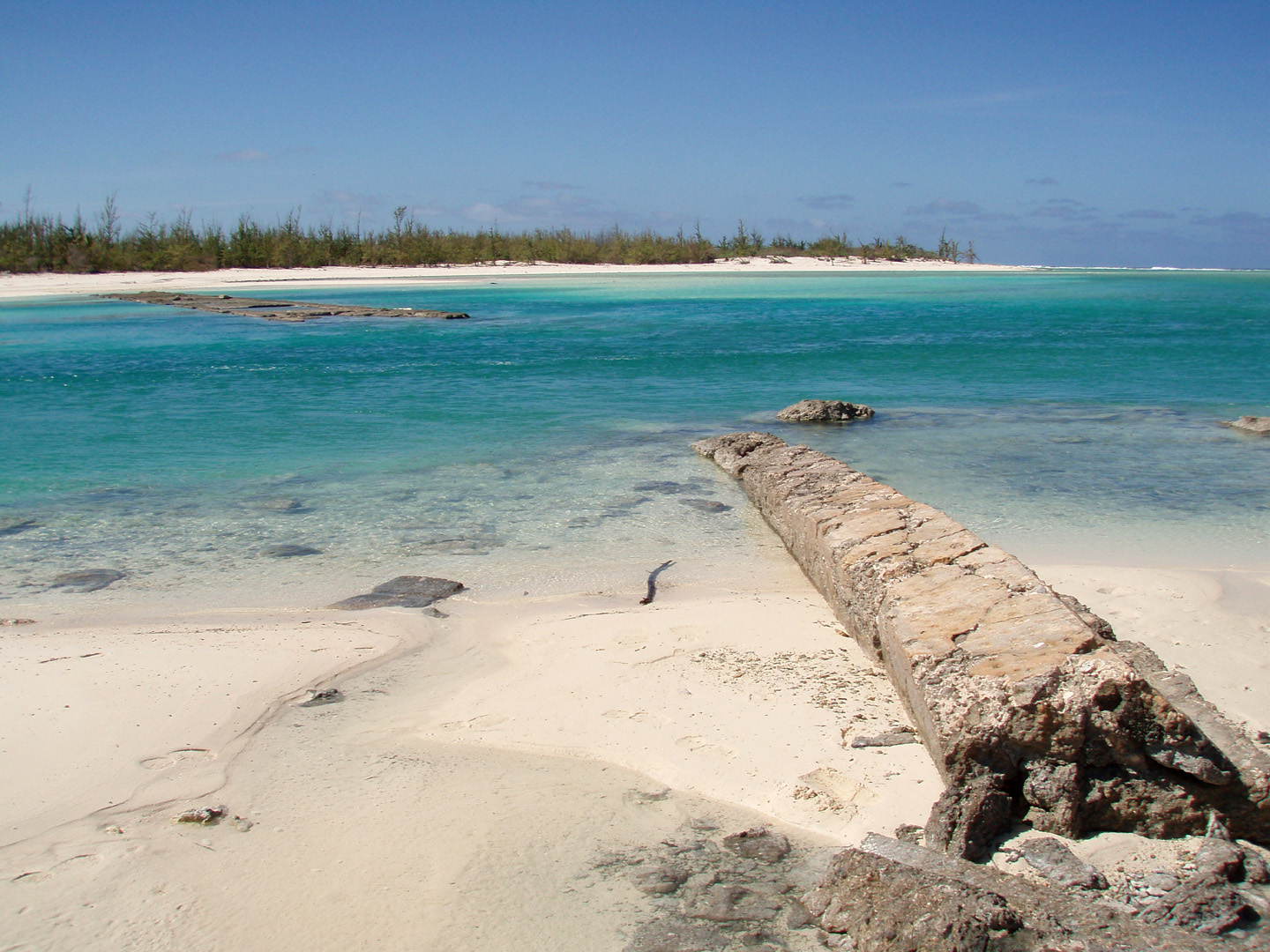
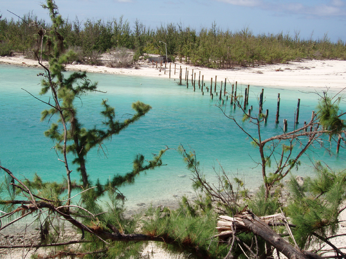
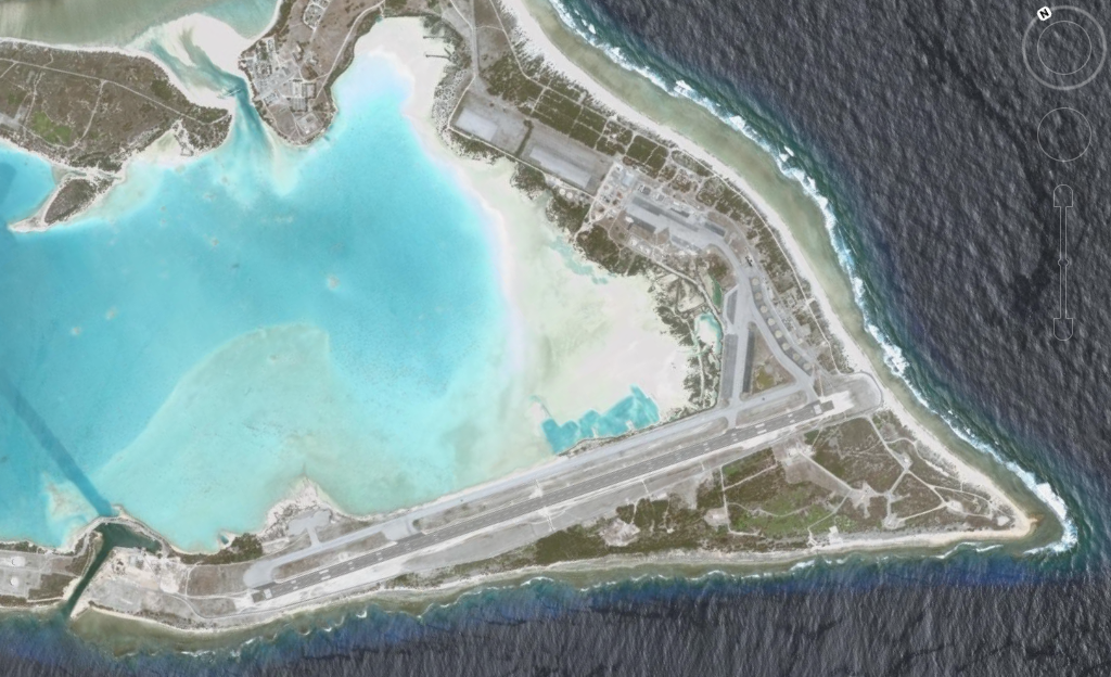
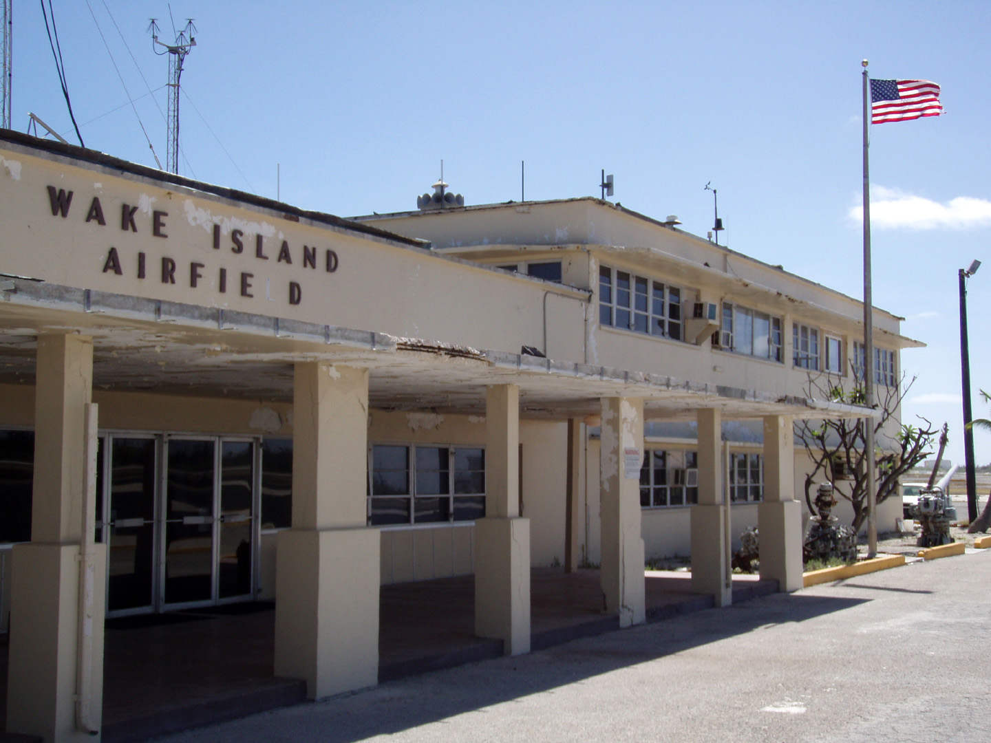
The REAL Wake Island 19° 16' 53.38" N, 166° 38' 55.06" E ..
..
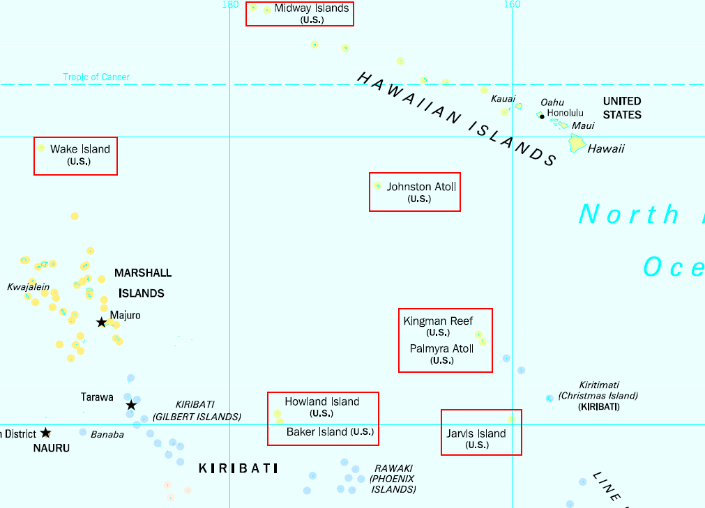
United States Minor Outlying
Islands
The United States Minor Outlying Islands, a statistical designation defined by the International Organization for Standardization's ISO 3166-1 code, consists of nine United States insular areas. Palmyra Atoll is the only incorporated territory. As of 2008, none of the islands has any permanent residents. The only human population consists of temporarily stationed scientific and military personnel. The 2000 census counted 315 people on Johnston Atoll and 1 person on Wake Island. There has been no indigenous population, except at the 1940 census. The Baker, Howland and Jarvis Colonization Scheme attempted to settle Americans on those three islands beginning in 1935, but all three islands were evacuated in 1942 as a result of World War II. The islands are grouped together as a statistical convenience. They are not administered collectively, nor do they share a single cultural or political history beyond being uninhabited islands under the sovereignty of the United States. They are collectively represented by the ISO 3166-1 alpha-2 code UM. The individual islands have ISO 3166-2 numerical codes, see ISO 3166-2:UM. The Internet country code top-level domain (ccTLD) ".um" has historically been assigned to the islands; however, the .um ccTLD was retired in January 2007. The term "United States Minor Outlying Islands" was introduced in 1986. From 1974 until 1986, five of the islands (Baker Island, Howland Island, Jarvis Island, Palmyra Atoll and Kingman Reef) were grouped under the term US Miscellaneous Pacific Islands, with ISO 3166 code PU (the code of Midway Atoll was MI, and the code of Johnston Atoll JT). SOURCE: Wikipedia; United_States_Minor_Outlying_Islands
..
..
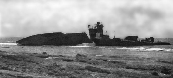
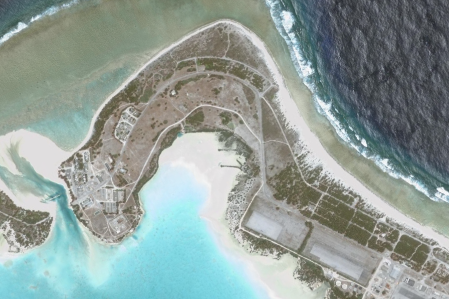
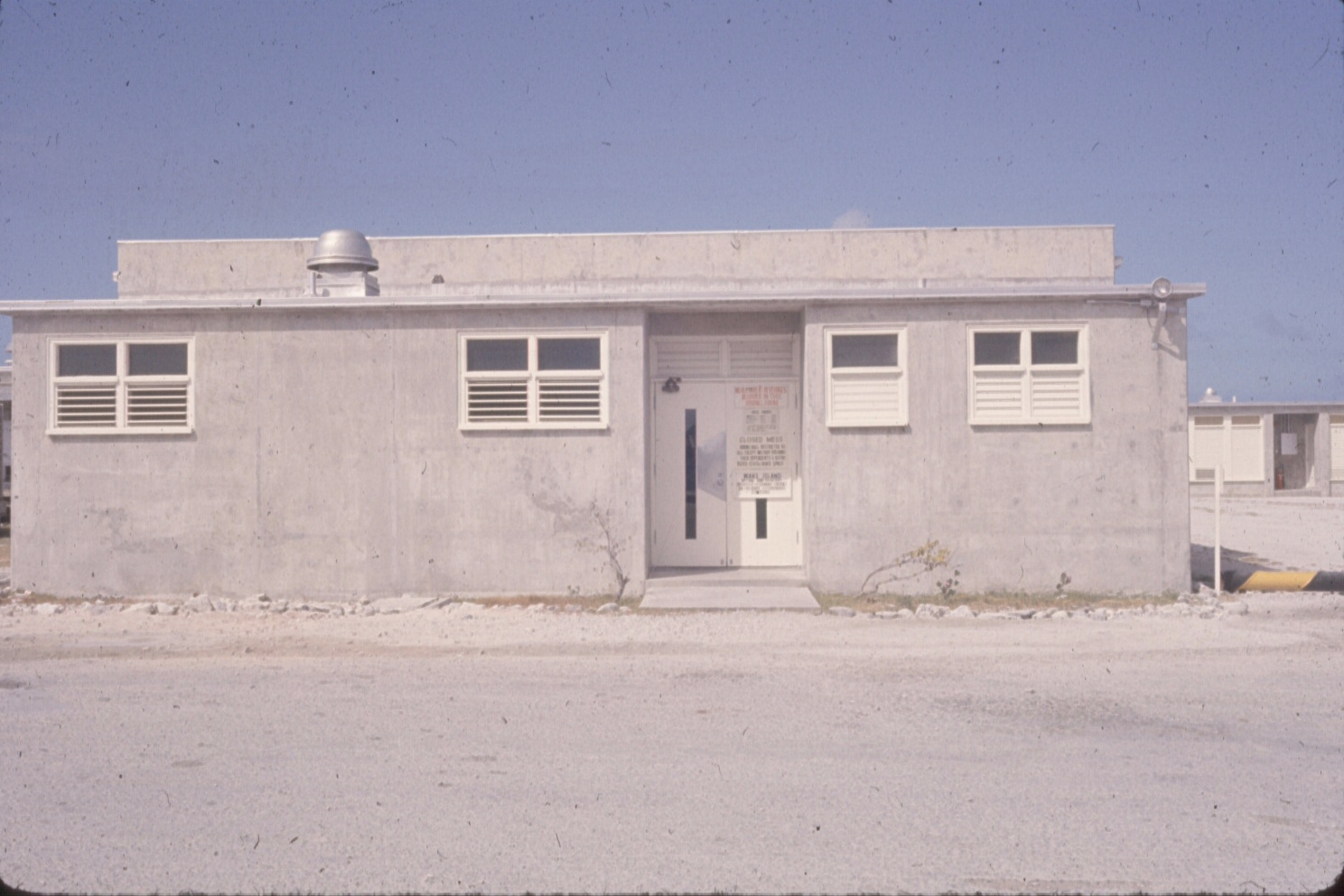
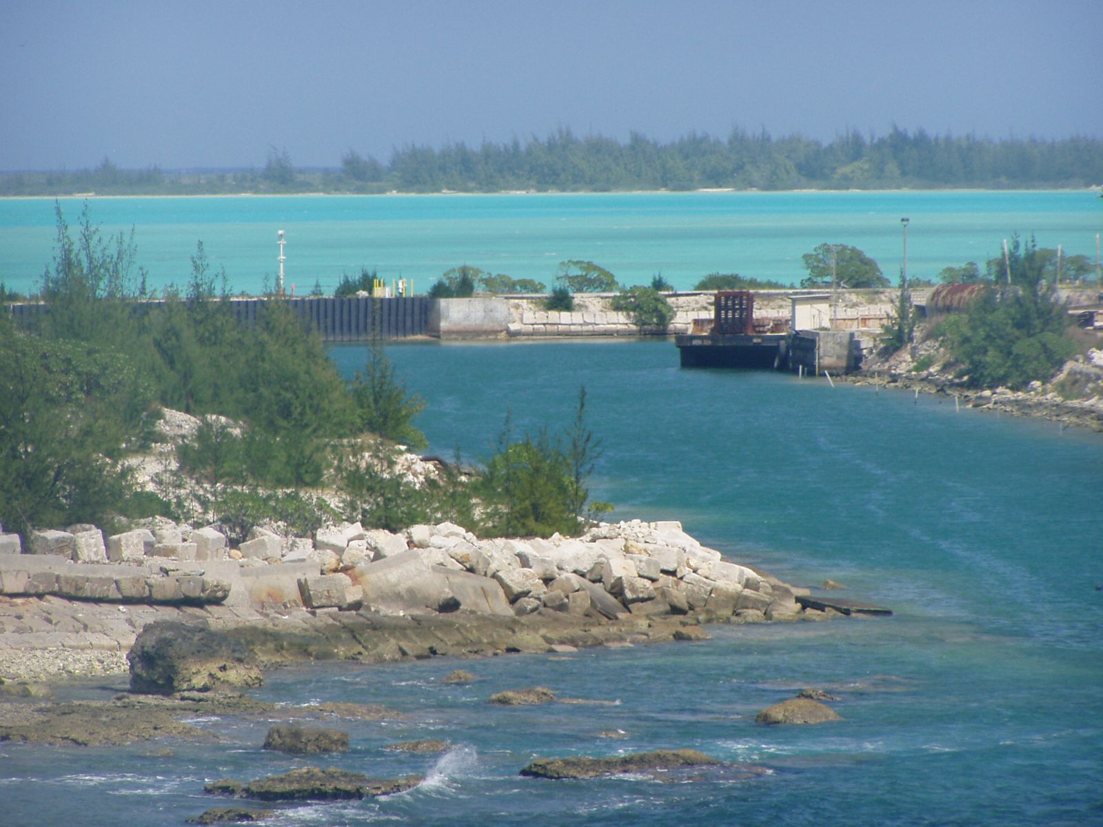
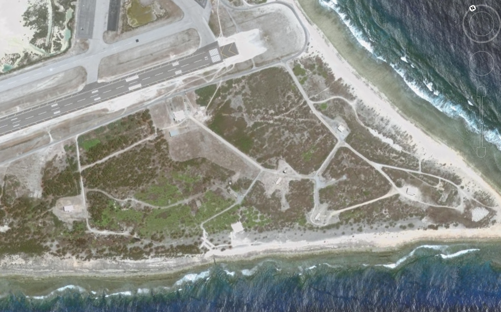
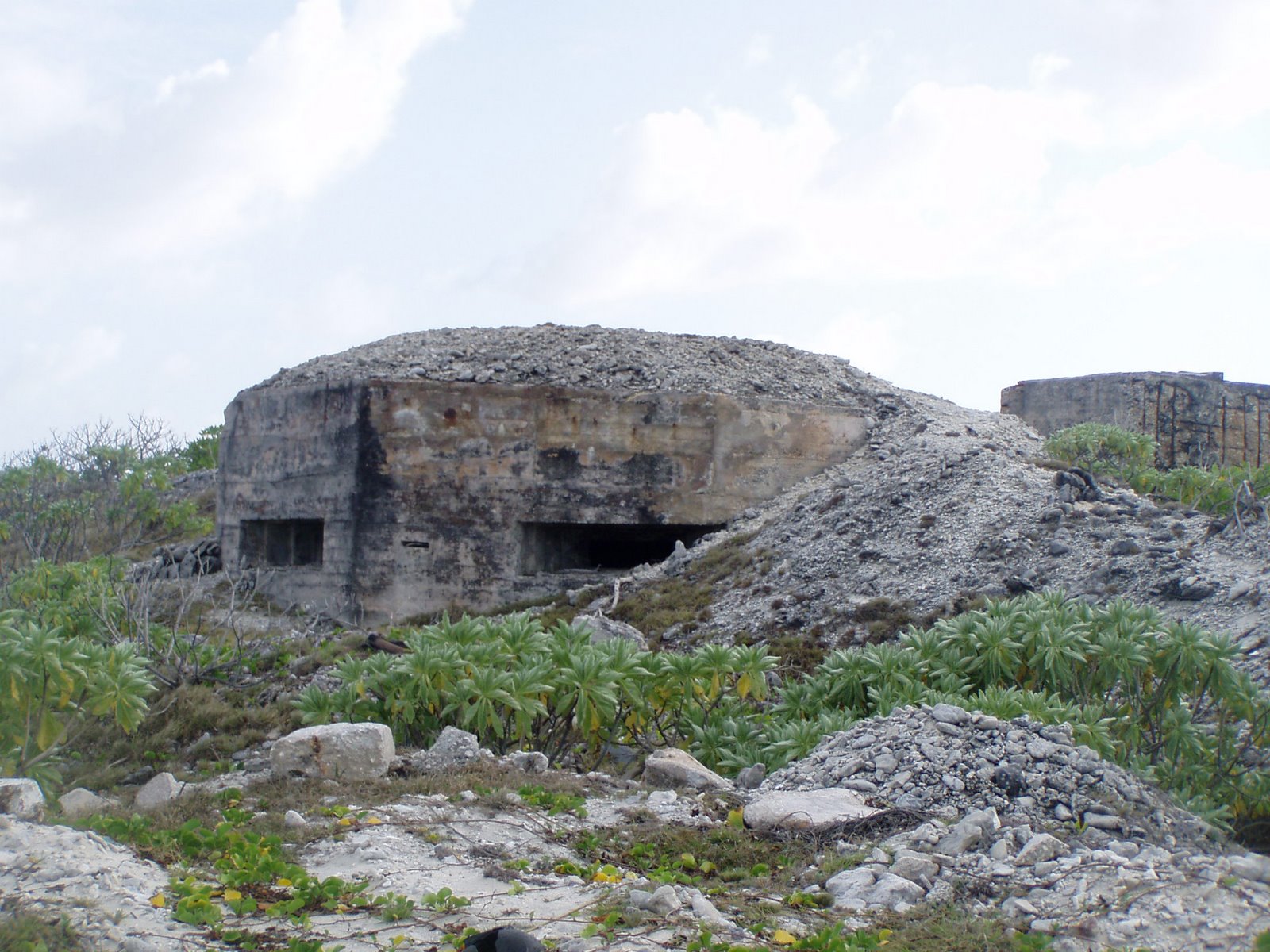
#2 - No Picture - Seaplane ramp and old seaplane base on Peale, next to Wake Island. Battle of Wake Island
Date December 8, 1941 – December 23, 1941 The Battle of Wake Island began simultaneously with the Attack on Pearl Harbor and ended on December 23, 1941, with the surrender of the American forces to the Japanese. It was fought on and around the atoll formed by Wake Island and its islets of Peale and Wilkes Islands by the air, land and naval forces of the Empire of Japan against those of the United States of America, with Marines playing a prominent role on both sides. The island was held by the Japanese until September 4, 1945, when the remaining Japanese garrison surrendered to a detachment of United States Marines. SOURCE: Wikipedia; Battle of Wake Island
..
..
..
..
..
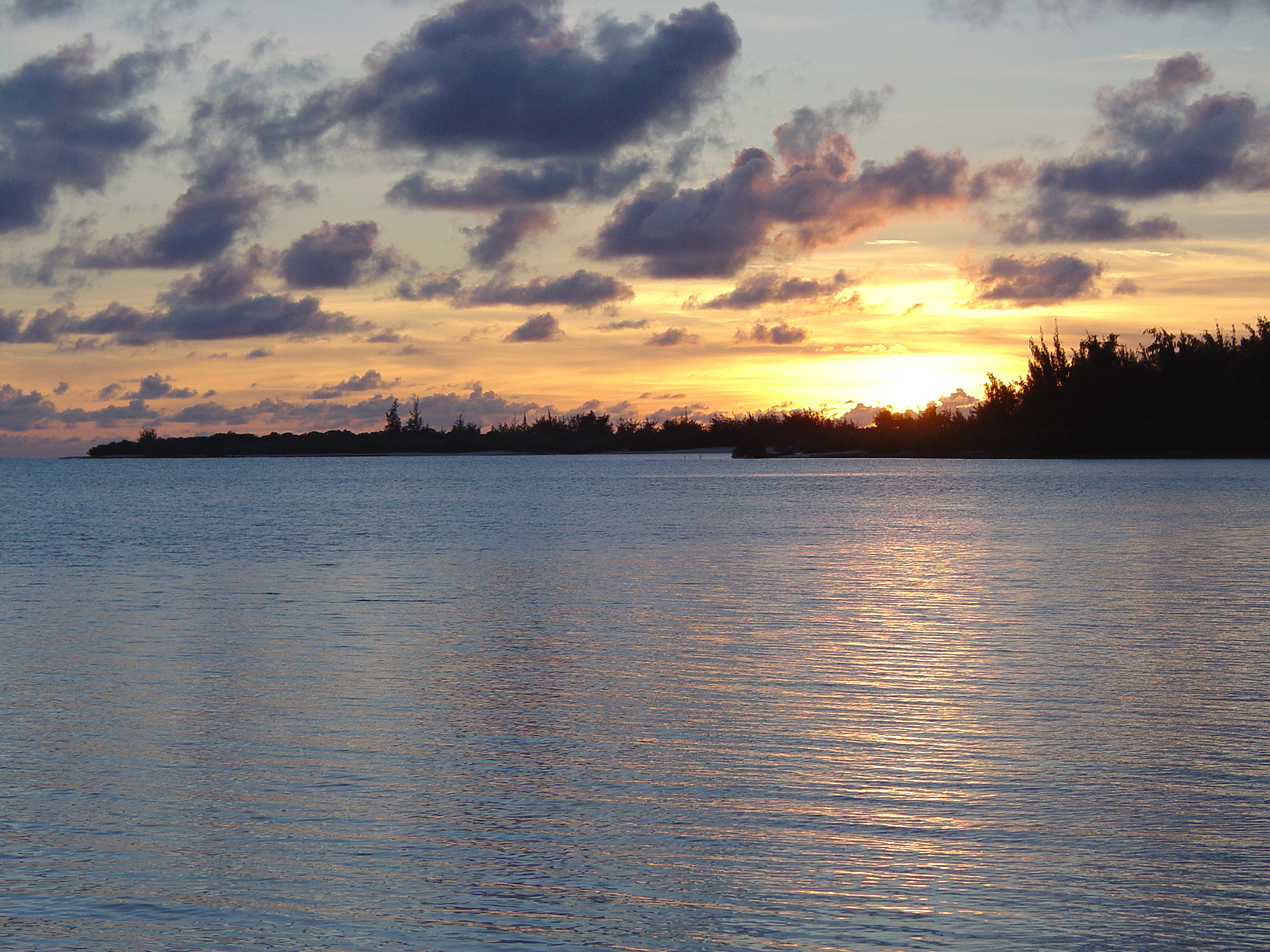
ake Island (also known as Wake Atoll, pronounced /ˈweɪk/)
is a coral atoll having a coastline of 12 miles (19 kilometers) in the
North Pacific Ocean, located about two-thirds of the way from Honolulu
(2,300 statute miles or 3,700 km west) to Guam (1,510 miles or 2,430 km
east). It is an unorganized, unincorporated territory of the United States,
administered by the Office of Insular Affairs, U.S. Department of the Interior.
Access to the island is restricted, and all current activities on the island
are managed by the United States Air Force and the United States Army.
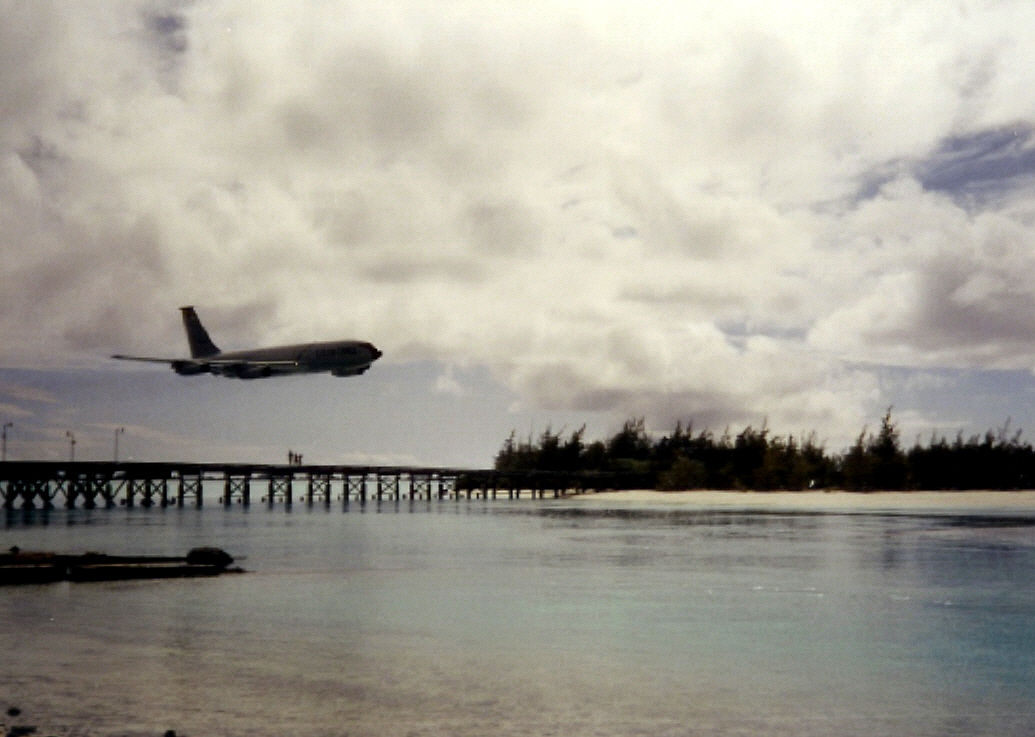
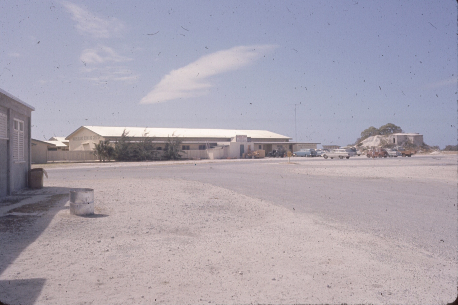
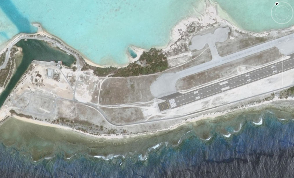
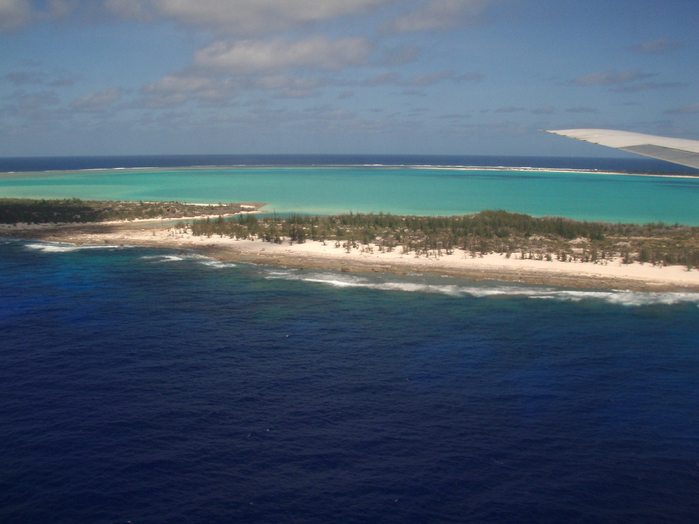
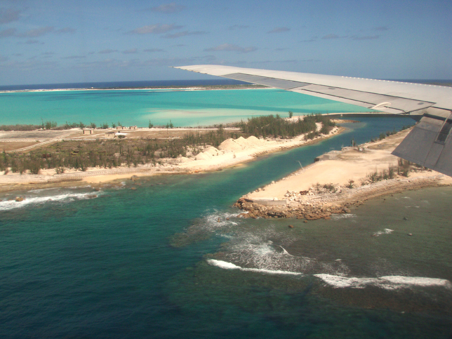
The largest island (Wake Island) is the center of activity on the atoll
and has a 9,800 foot (3,000 m) runway.
For statistical purposes, Wake is grouped as one of the United States Minor Outlying Islands SOURCE: Wikipedia; Wake Island
..
..
..
..
..
..
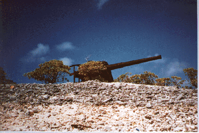
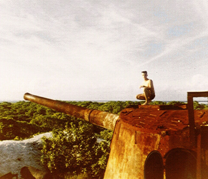
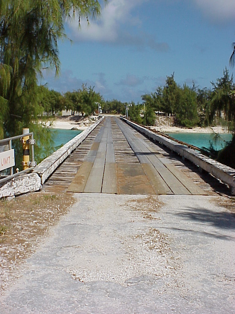
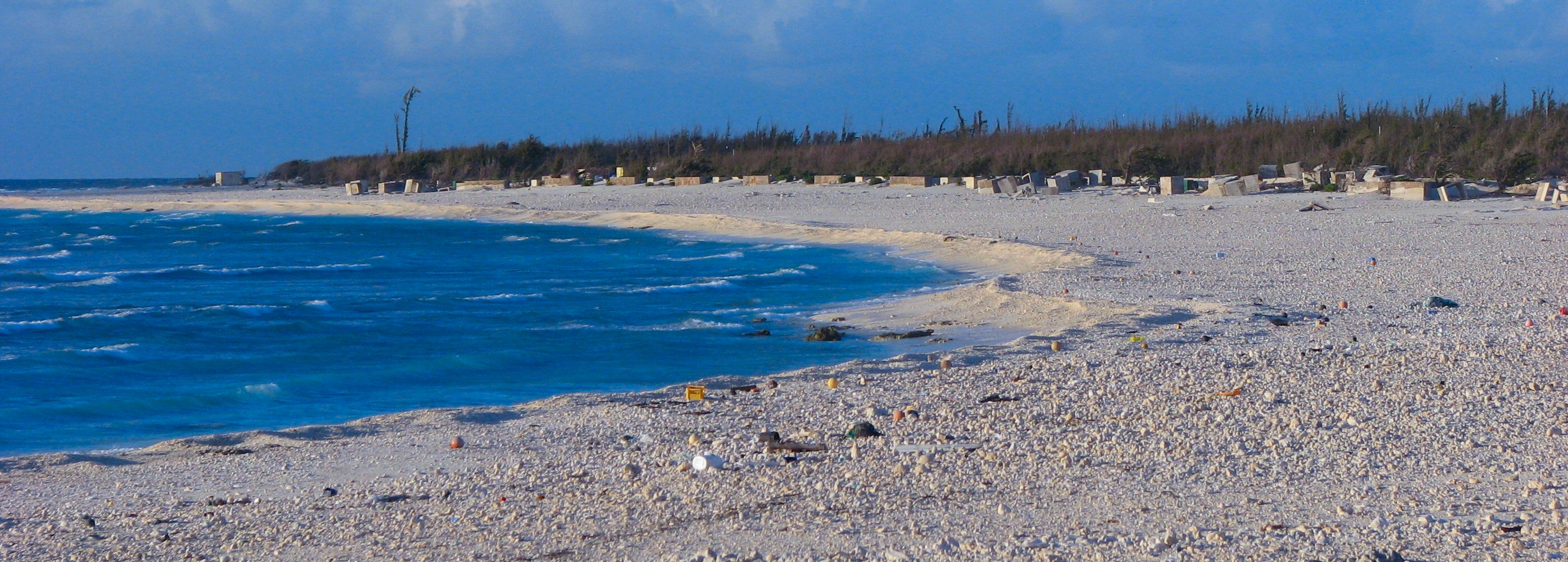
The US annexed Wake Island in 1899 for a cable station. An important air and naval base was constructed in 1940-41. In December 1941, the island was captured by the Japanese and held until the end of World War II. In subsequent years, Wake was developed as a stopover and refueling site for military and commercial aircraft transiting the Pacific. Since 1974, the island's airstrip has been used by the US military, as well as for emergency landings. All operations on the island were suspended and all personnel evacuated in August 2006 with the approach of super typhoon IOKE (category 5), which struck the island with sustained winds of 250 kph and a 6 m storm surge inflicting major damage. A US Air Force assessment and repair team returned to the island in September and restored limited function to the airfield and facilities. The future status of activities on the island will be determined upon completion of the survey and assessment. SOURCE: CIA Factbook Wake Island
..
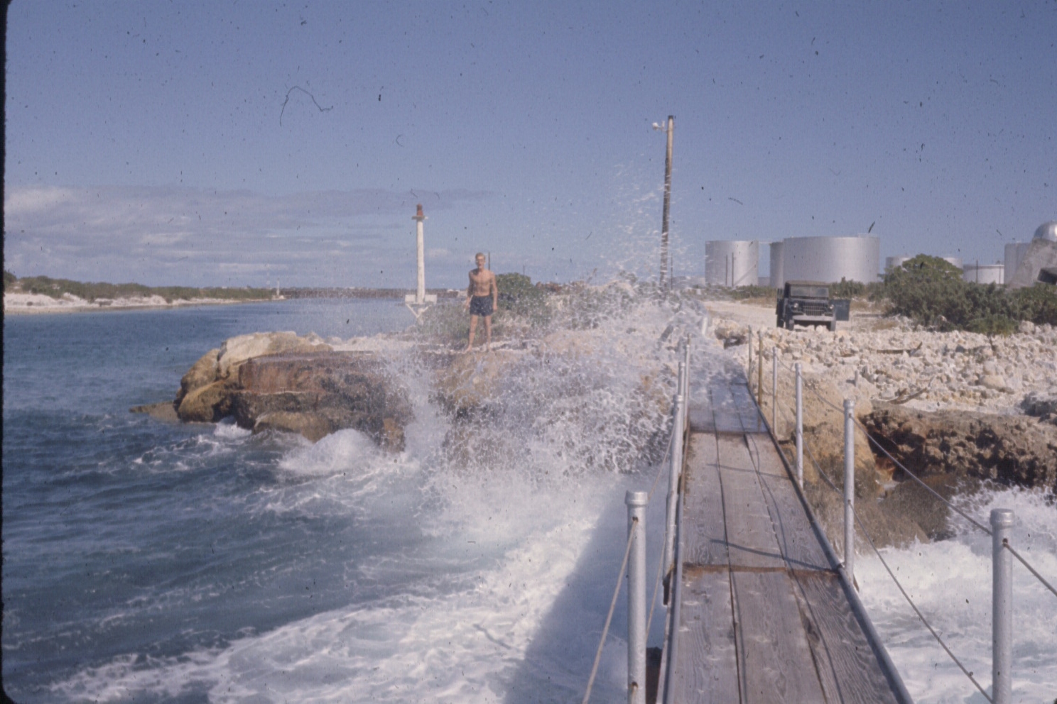
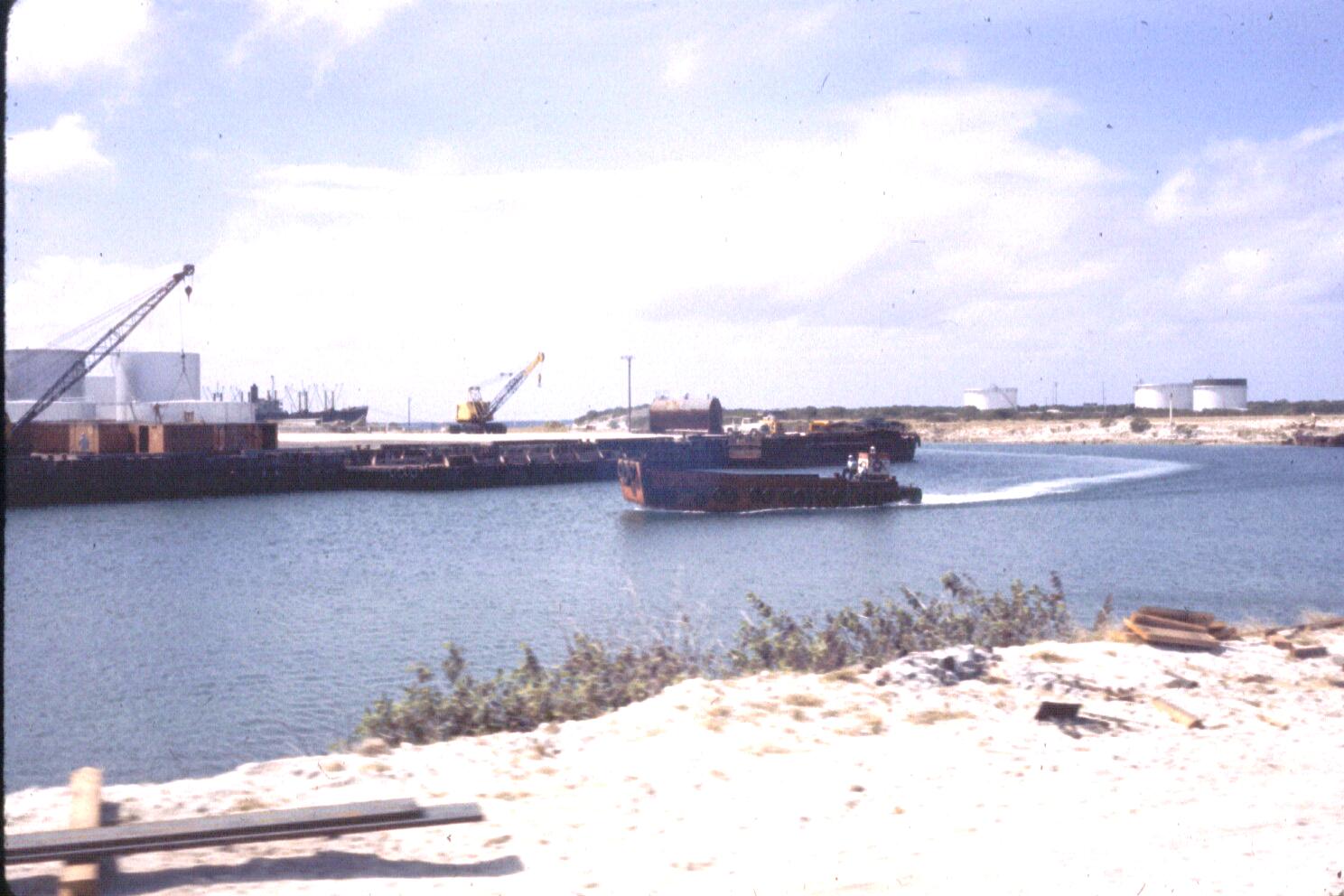
Fuel Tanks (right) ..
..
..
..
..
..
..
Wake Island, located 1,100 kilometers north of the Kwajalein Atoll, is a functional adjunct to RTS, providing a launch site for intermediate range NMD and TMD target missiles. Program requirements, mission planning and implementation, and logistics support are coordinated through the Reagan Test Site. The mission of the Ronald Reagan Ballistic Missile Defense Test Site (RTS) is to provide a Major Range Test Facility Base (MRTFB) activity on Kwajalein Atoll & Wake Island to support:  SOURCE: US Army Ronald Reagan Ballistic Missile Defense Test Site (RTS)
..
..
..
..
|
||||||||||||||||||||||||||||||||||
| FAIR USE NOTICE: This page contains copyrighted material the use of which has not been specifically authorized by the copyright owner. Pegasus Research Consortium distributes this material without profit to those who have expressed a prior interest in receiving the included information for research and educational purposes. We believe this constitutes a fair use of any such copyrighted material as provided for in 17 U.S.C § 107. If you wish to use copyrighted material from this site for purposes of your own that go beyond fair use, you must obtain permission from the copyright owner. | ||||||||||||||||||||||||||||||||||
|
|