|
The Enigmas on Venus |
|||
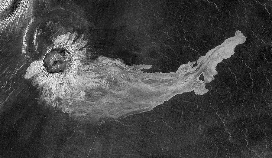
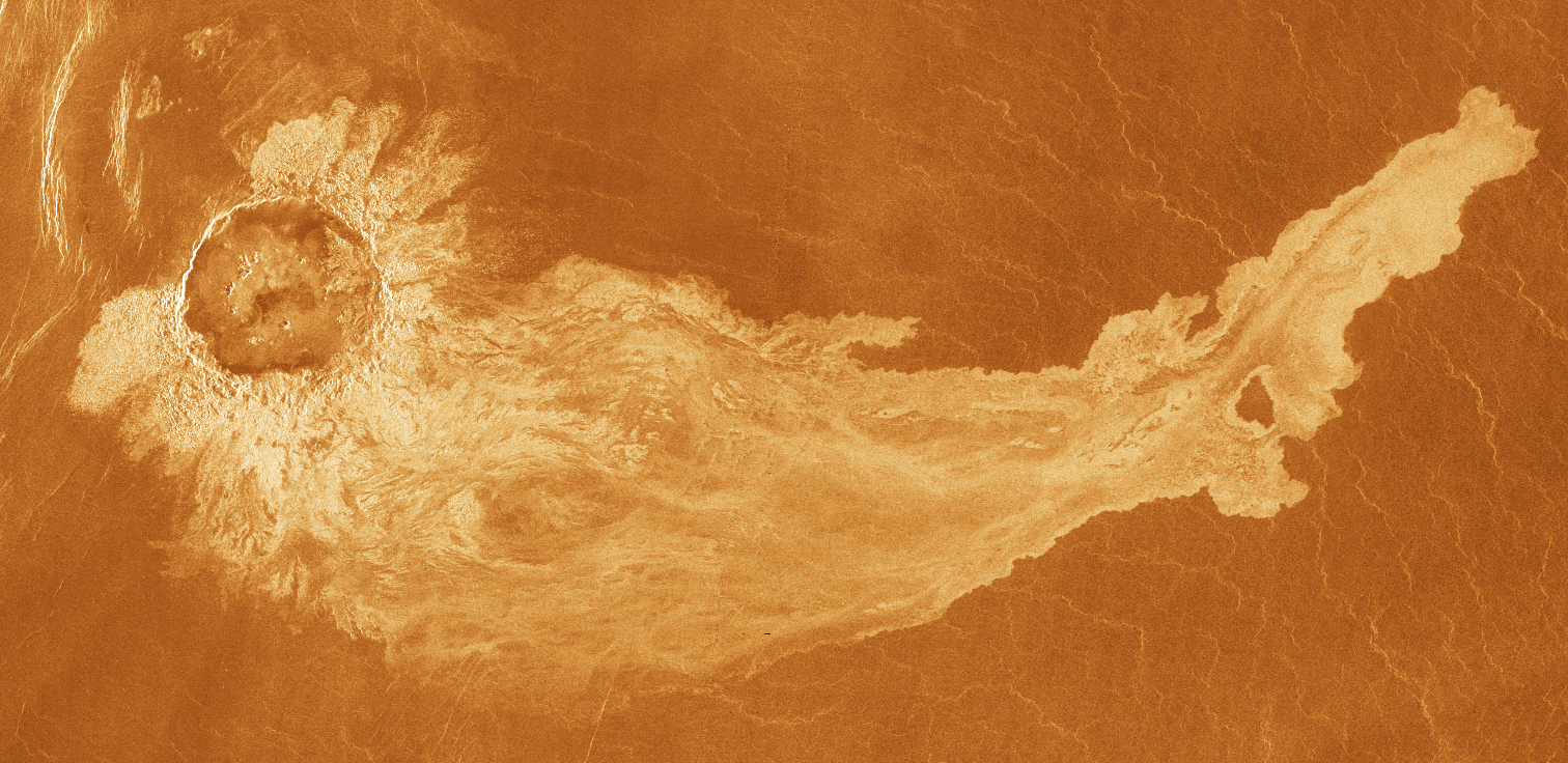
Addams crater is remarkable for
the extensive outflow
that extends 600 kilometers (373 miles) from the
crater rim. Because of
the high temperature and pressure on the Venusian
surface, impacts produce
more melt than on other planets. Outflow deposits
are very thin. Their
direction is controlled by the local topography.
Magellan radar image of Addams crater, Venus. The radar bright outflow associated with the 90 km crater stretches over 600 km to the east. (North is up.) The crater is located at 56.1S,98.9E in the Aino Planitia region. (Magellan C2-MIDR 60S093;202,framelets 21 and 29) |
|||
University Corporation for Atmospheric Research (UCAR), University of Michigan |
|||
|
.
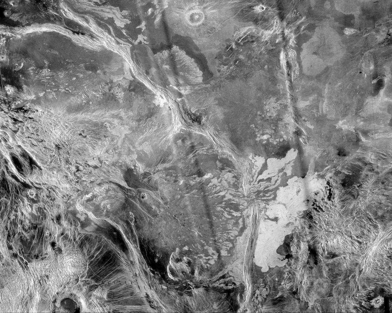
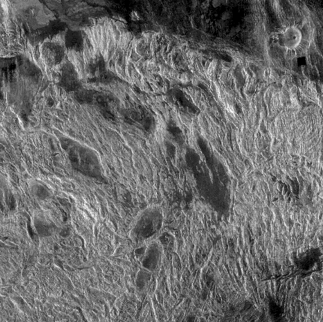
University Corporation for Atmospheric Research (UCAR), University of Michigan Alternate Source NASA This mosaic highlights a system of east-trending, radar-bright and dark lava flows that collide with and breach a north-trending ridge belt (left of center). Upon breaching the ridge belt, the lava pooled, forming a radar-bright deposit approximately 100,000 square km (right side of image). The source of the lava is the Corona Derceto, which lies about 300 km (186 mi) west of the scene. The bright and dark bars extending from top to bottom are artifacts of image processing. |
|||
University Corporation for Atmospheric Research (UCAR), University of Michigan |
|||
|
.
University Corporation for Atmospheric Research (UCAR), University of Michigan |
|||
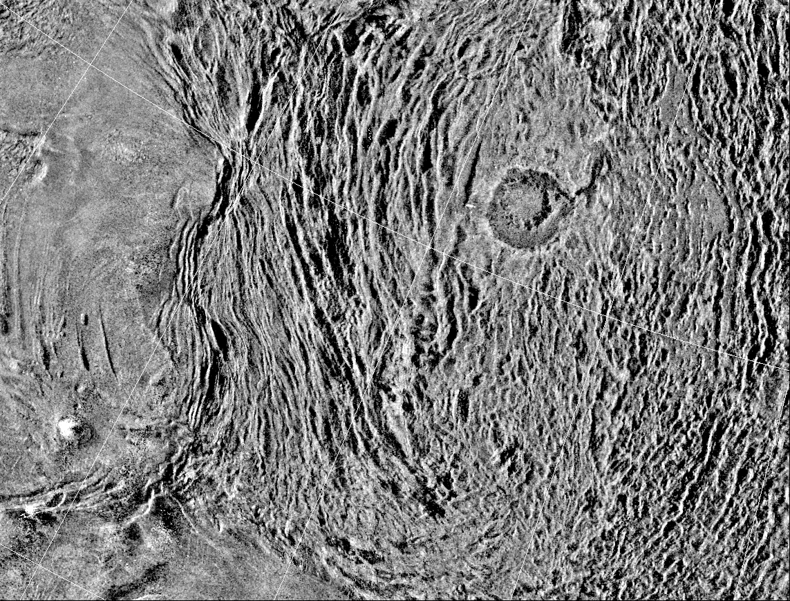
This is a radar
image of a region in a vast plain to the
south of Aphrodite Terra. The large circular
structure near the center
is a corona, about 200 kilometers in diameter, named
Aine Corona. It is
one of the flat-topped volcanic constructs known as
"pancake" domes for
their resemblance to pancakes. NASA/JPL
University Corporation for Atmospheric Research (UCAR), University of Michigan |
|||
|
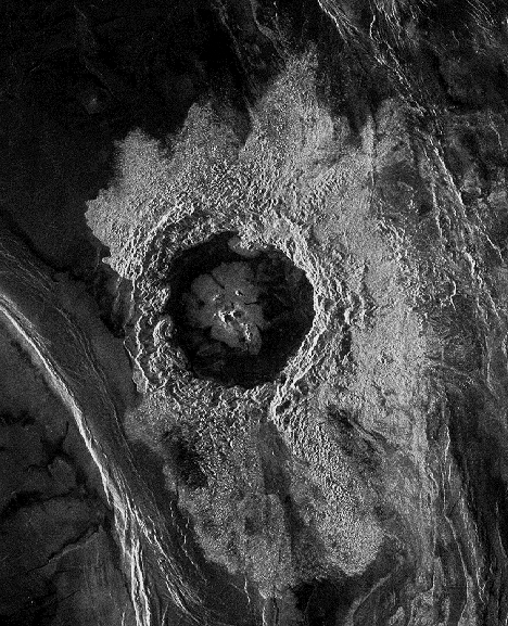
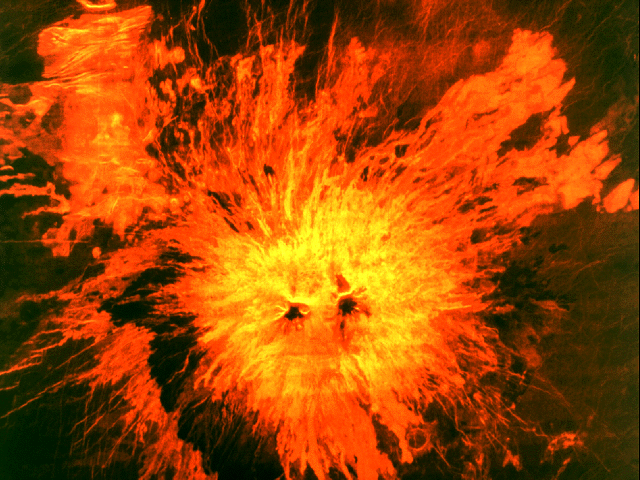
Addams Crater
Many photos of Venus shown on
various NASA websites
always have an orange color. This orange color was
added to the photos
to give the impression of a hot lava world and these
have been accepted
as the norm by many people. But since the Magellan
images were radar generated,
the color had to be added after. Who picked the
color is unknown, but that
it was dileberately added is obvious. If you compare
the different orange
images on the web you will see drastic differences
in the shade, like the
one below.
University Corporation for Atmospheric Research (UCAR), University of Michigan
It would seem a lot of creativity goes into the coloring of Venus to show us the hot lava flows beneath the dense clouds that rain sulphuric acid... |
|||
|
.
The surface detail was created in the Southern Methodist University Geophysical Imaging Laboratory using a technique developed at SMU for retrieving fine-scale topographic features from radar reflectivity. The color scheme is derived from the radar patterns and basaltic composition of the rocks. The clouds are computer generated to give a sense of size and depth. The obscuring haze was rendered in order to suggest the 900 degree temperatures common on the surface of Venus. by
So what this shows is that the radar
data can be interpreted
in many ways... I like the blue skies
|
|||
| FAIR USE NOTICE: This page contains copyrighted material the use of which has not been specifically authorized by the copyright owner. Pegasus Research Consortium distributes this material without profit to those who have expressed a prior interest in receiving the included information for research and educational purposes. We believe this constitutes a fair use of any such copyrighted material as provided for in 17 U.S.C § 107. If you wish to use copyrighted material from this site for purposes of your own that go beyond fair use, you must obtain permission from the copyright owner. | |||
|
|