|
The Enigmas on Earth Impact Craters on Earth |
||||
|
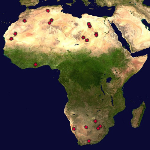
Africa .
Earth Impact Database - The biggest collection of Earth Impact Craters by the University of New Brunswick, Canada Visit Also:
|
||||
|
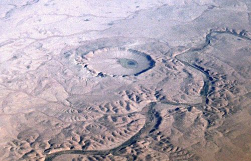
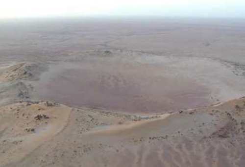
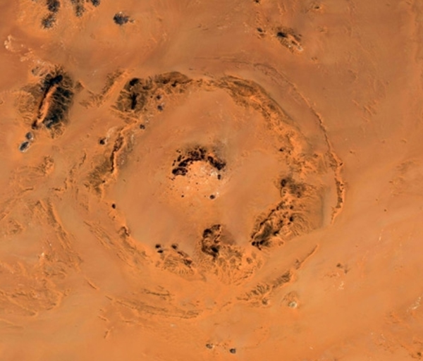
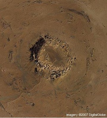
Amguid Crater Algeria .
|
||||
|
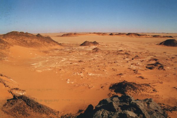
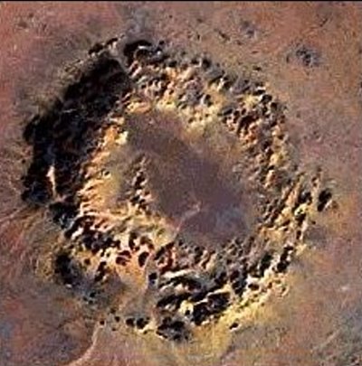
Ouarkziz Crater Algeria .
|
||||
|
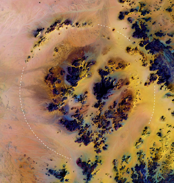
Talemzane Crater Algeria .
|
||||
|
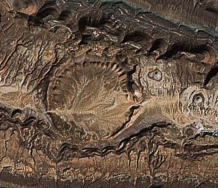
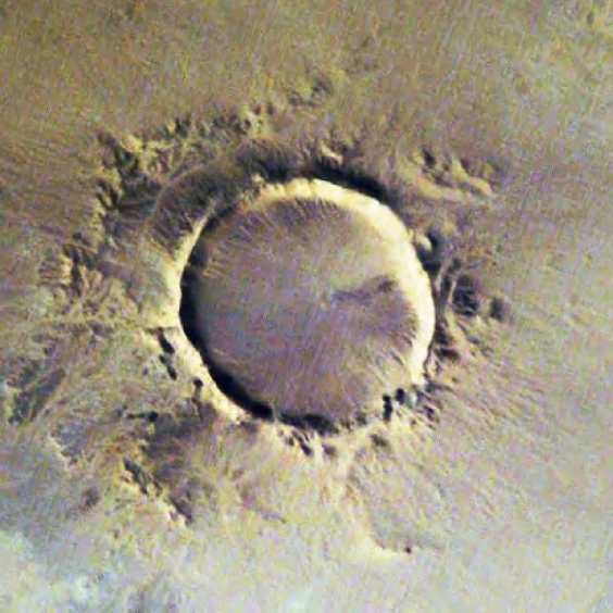
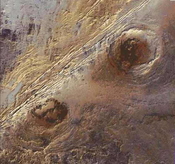
Tin Bider Crater Algeria .
Tin Bider Crater
is an impact crater (astrobleme) in Algeria.
It is 6 km in diameter and the age is estimated to
be less than 70 million
years (Cretaceous or younger). The crater is exposed
to the surface.
|
||||
|
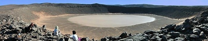
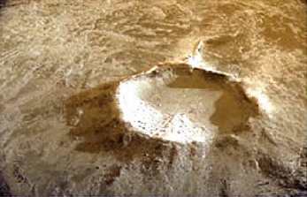
Tenoumer Crater Mauritania .
The Tenoumer crater
is about 1,900 m in diameter and
is located in the western Sahara desert, Mauritania.
The crater is almost
perfectly round in shape, and the rim is 110 m high
from bottom to top.
Tenoumer is located on a peneplain consisting of
Precambrian gneisses and
granites. A thin layer of sediments that are
Pliocene or younger covers
the Precambrian rocks. Tenoumer is located on top of
the Pliocene sediments.
Due to the rare occurrence of fused igneous
materials outside the crater,
(basalt and rhyodacite) a volcanic origin was
favored. The origin of the
crater Tenoumer by an impact is currently preferred.
Basement rocks have
been found in outcrops outside of the crater,
located in individual bodies
up to 20 m long. These rocks are dark gray,
vesicular, and contain altered
gneiss and granite clasts. Small fractured glass
inclusions are also present.
Several deformation features have been found at
Tenoumer. The most prominent
of these is planar deformation features in quartz
grains; the presence
of lechatelierite (glass), and deformation of
biotite, feldspar, and other
minerals. - Source
The "Impact" Craters of Mauritania Aouelloul, Tenoumer, Temimichat and El Mrayer by Norbert Brügge, Germany
|
||||
|
Aouelloul Crater Mauritania .
The crater Aouelloul is located in the Adrar region of the western Sahara Desert, Mauritania. The crater is one of the smaller known craters, having a diameter of 390 m. The rim is well defined and rises 15-25 m above the local topography, and 53 m above the crater floor. The crater is located in Ordovician sand stones and quartzite, and is filled with sandy silt and Aeolian sand. Estimates of the thickness of this sedimentary fill are around 23 m... At Aouelloul, the Os ratios of the glass are extremely similar to those of both chondritic and iron meteorites. This suggests that the Os present in the glass came from a meteorite, as the amount present is much too high to have had a terrestrial origin. An absolute age of 3.1±0.3 million years was obtained by fission track and K-Ar dating of the impact glass... - Source |
||||
|
Temimichat Crater Mauritania .
The crater rim is not completely preserved. Large portions are eroded and dissected, or masked by eolian deposits. The rim is mostly formed by granitoid gneisses. The low lying portions of the rim correspond to the occurrence of gabbroic dikes, which seem to be more easily erodible, with respect to the dominant granitoid bedrock. The crater interior is covered by recent eolian Sediments. Below this surficial cover, sedimentary deposits are likely filling the crater.
New Evidences of an Impact Origin for Temimichat Crater, Mauritania - LPI Pdf |
||||
|
El Mrayer Crater Mauritania .
The crater has a
diameter of about 2 km and it is located
on Cambro-Ordovician substrate. The geometry appears
rather complex: a
subcircular inner ring is bound by an apparently
concentric deformed region.
Nearby (2 km toward N) a possible secondary small
crater is visible.
Source: LPI
1309
PDF |
||||
|
Gogui Crater Mauritania .
The crater is about 500-600 m wide and shows a relatively pristine morphology. The bedrock consists of Paleozoic metamorphic rocks. It has a distinct circular rim and a rather flat bottom. The age of formation of the crater could be very recent, looking at its pristine aspect. Source: LPI 1309 PDF |
||||
|
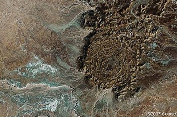
Richat Structure Crater Mauritania .
|
||||
|
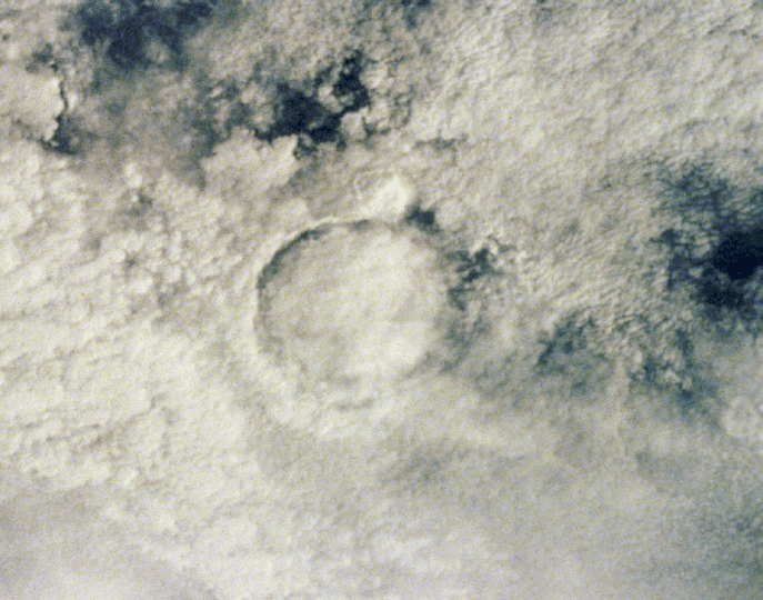
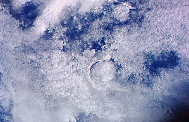
Bosumtwi Crater Ghana, West Africa .
This crater is
situated in crystalline bed rocks of
the West African Shield and is filled almost
entirely by Lake Bosumtwi.
Chemical, isotopic, and age studies demonstrate that
the crater is the
most probable source for the Ivory Coast tektites,
which are found on land
in the Ivory Coast region of central Africa and as
micro tektites in nearby
ocean sediments. In this photo the crater lake is
partly obscured by clouds.
(Courtesy NASA/LPI)
Drillings made in the Bosumtwi
crater in Ghana, one
of the youngest meteorite craters in the world, led
to yet another mysterious
finding - the rock formation caused by the heat of
the meteoric impact
is only half as thick as expected. - Source
and
Rest of Story
|
||||
|
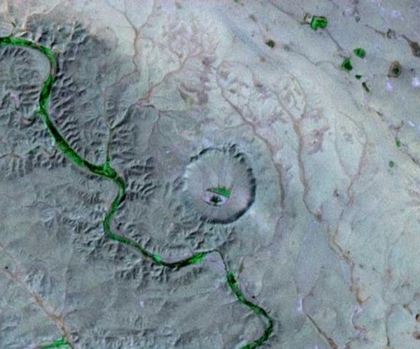
BP Structure Crater Libya .
The BP Structure,
also known as Gebel Dalma, is an impact
crater in Libya. It is so called because it was
found by a geological survey
team belonging to BP, formerly British Petroleum.
It is 2 km in diameter and the age is estimated to be less than 120 million years (Lower Cretaceous or later). The crater is exposed to the surface.
|
||||
|
Arkenu 1 & 2 Craters Libya .
The newly discovered structures are located 100 km west of Djebel Arkenu and 250 km south of Kufra oasis in Libya, at coordinates N22 deg 04', E23 deg 45'. It is a flat and hyperarid area, presenting a Cretaceous sandstone formation covered by active aeolian deposits and Quaternary soils, located tens of kilometers away from any track, in a hazardous zone due to the proximity of Second World War minefields. The optical Landsat-7 image shows a sandy region with large sand dunes trending SW-NE, while the corresponding L-band radar image extracted from the JERS-1 radar mosaic reveals two circular structures partially hidden by Quaternary deposits. The radar scene then clearly reveals a double circular structure composed of a southwestern crater 10.3 km in diameter and a northeastern crater of diameter 6.8 km. The NE crater is composed of concentric inner and outer rings separated by a depression filled with sediments, also observed in the optical scene. Its morphology is very similar to the Aorounga crater in Chad, corresponding to a typical complex crater. The SW crater also presents a circular shape with possibly three concentric annular ridges. The host rock of the double circular structure is a cross bedded coarse grained to conglomeratic sandstone of Lower Cretaceous age containing plant fossils and thin shale inter beds, leading to an estimated impact age of less than 140 Ma. |
||||
|
Oasis Crater Libya .
Oasis is a meteor
crater in Libya. It is 18 km in diameter
and the age is estimated to be less than 120 million
years (Lower Cretaceous).
The crater is exposed to the surface.
|
||||
|
Kibera Crater Egypt .
By Robert Roy Britt, Senior Science Writer Posted: 03 March 2006 Scientists have discovered a huge crater in the Saharan desert, the largest one ever found there. The crater is about 19 miles (31 kilometers) wide, more than twice as big as the next largest Saharan crater known. It utterly dwarfs Meteor Crater in Arizona, which is about three fourths of a mile (1.2 kilometers) in diameter. In fact, the newfound crater, in Egypt, was likely carved by a space rock that was itself roughly 0.75 miles wide in an event that would have been quite a shock, destroying everything for hundreds of miles. For comparison, the Chicxulub crater left by a dinosaur killing asteroid 65 million years ago is estimated to be 100 to 150 miles (160 to 240 kilometers) wide. |
||||
|
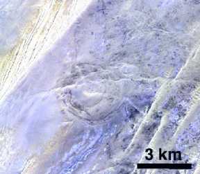
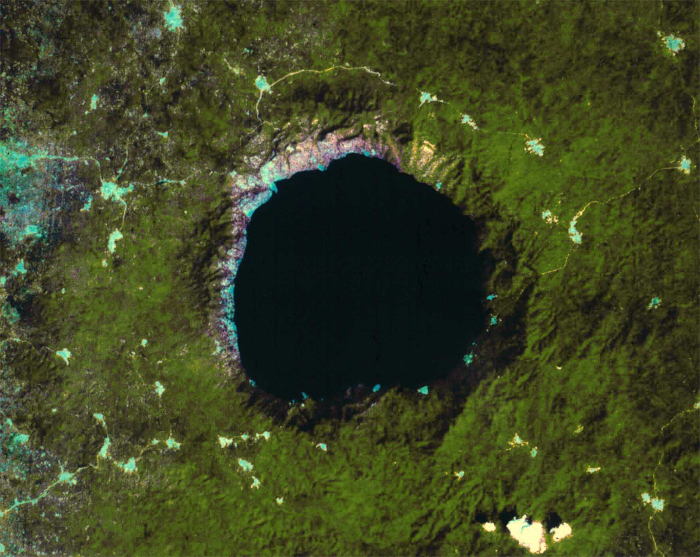
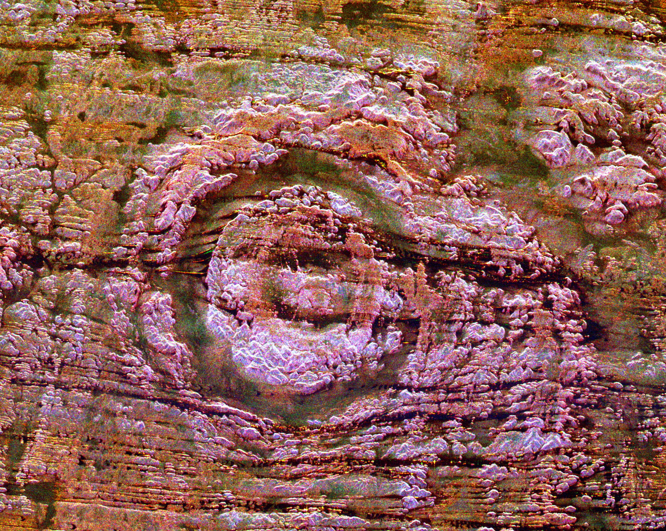
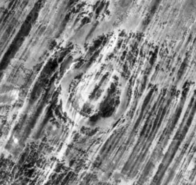
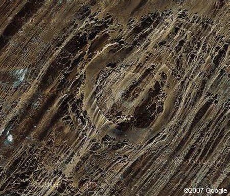
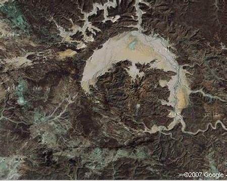
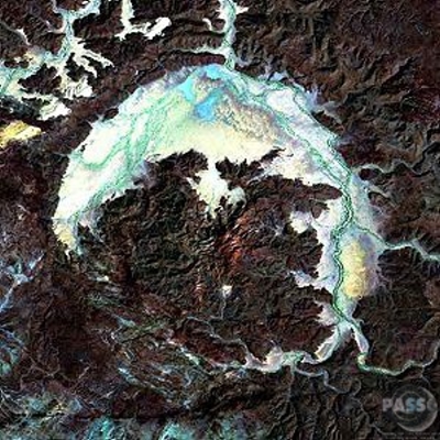
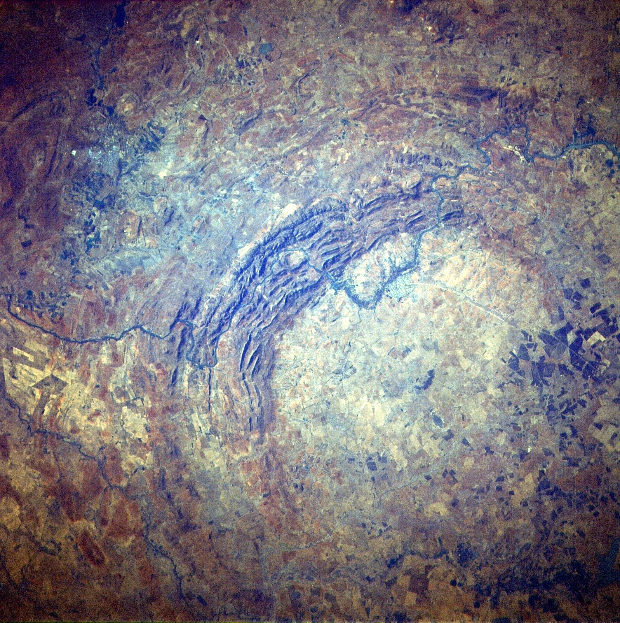
Aorounga Crater Chad, Africa .
The impact of an asteroid or comet several hundred million years ago left scars in the landscape that are still visible in this space borne radar image of an area in the Sahara Desert of northern Chad. The concentric ring structure is the Aorounga impact crater, with a diameter of about 17 kilometers (10.5 miles). The original crater was buried by sediments, which were then partially eroded to reveal the current ring like appearance. The dark streaks are deposits of windblown sand that migrate along valleys cut by thousands of years of wind erosion. The dark band in the upper right of the image is a portion of a proposed second crater. Scientists are using radar images to investigate the possibility that Aorounga is one of a string of impact craters formed by multiple impacts. Radar imaging is a valuable tool for the study of desert regions because the radar waves can penetrate thin layers of dry sand to reveal details of geologic structure that are invisible to other sensors. The image was acquired by the Spaceborne Imaging Radar-C/X-band Synthetic Aperture Radar (SIR-C/X-SAR) on April 18 and 19, 1994, onboard the space shuttle Endeavor. The area shown is 22 kilometers by 28 kilometers (14 miles by 17 miles) and is centered at 19.1 degrees north latitude, 19.3 degrees east longitude. North is toward the upper right. The colors are assigned to different radar frequencies and polarization as follows: red is L-band, horizontally transmitted and received; green is C-band, horizontally transmitted and received; and blue is C-band, horizontally transmitted, vertically received. SIR-C/X-SAR, a joint mission of the German, Italian and United States space agencies, is part of NASA's Mission to Planet Earth program. This image is in the public domain
and is copyright
free. - SOURCE:
Solar
Views
|
||||
|
Gweni Fada Crater Chad, Africa .
Gweni-Fada is a
meteor crater in Chad, Africa. It is 14
km in diameter and the age is estimated to be less
than 345 million years
(Carboniferous). The crater is exposed to the
surface.
|
||||
|
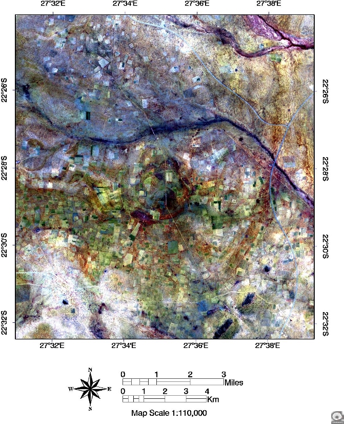
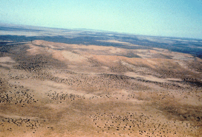
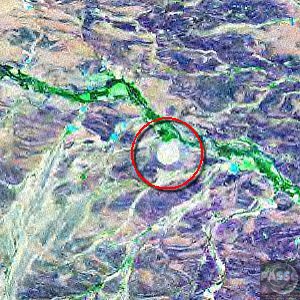
Kgagodi Basin Impact Structure Botswana .
Kgagodi basin,
located at 27°34.4E/22°28.6S in
eastern Botswana, is a confirmed impactstructure (Brandt et al., 2002). The
surface expression
of this 3.4 km wide structure iscompletely eroded, and the crater was only
discovered
as a result of gravity studies inpreparation of hydrological
drilling.
See Also
|
||||
|
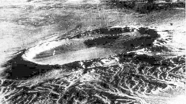
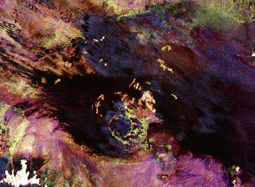
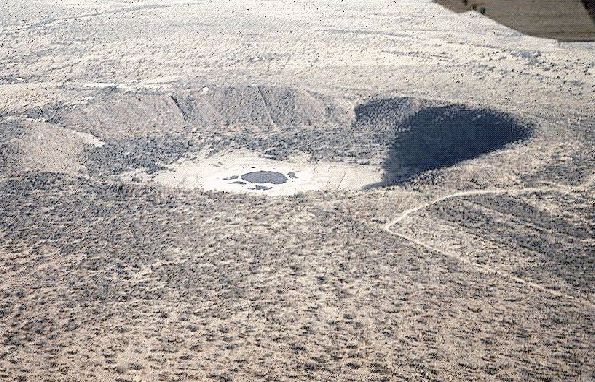
Roter Kamm Namibia, South West Africa .
Located in the
Namibia Desert, the raised crater rim
is clearly visible against darker background
vegetation. Target rocks include
primarily Precambrian crystalline rocks and modest
amounts of younger sedimentary
rocks. Outcrops of impact melt breccias are found
exclusively on the crater
rim. The crater floor is covered by broad, shifting
sand dunes. This image
shows an oblique view of the crater, from about 150
meters (492 feet) above
ground looking southeast. (Courtesy of W. U. Reimold
and LPI)
This space radar image shows the Roter Kamm impact crater. The crater rim is seen as a radar bright, circular feature. The bright white, irregular feature in the lower left corner is a small hill of exposed rock outcrop. Roter Kamm is a moderate sized impact crater, 2.5 kilometers (1.55 miles) in diameter, and is 130 meters (427 feet) deep. However, its original floor is covered by sand deposits at least 100 meters (328 feet) thick. In a conventional aerial photograph, the brightly colored surfaces immediately surrounding the crater cannot be seen because they are covered by sand. The faint blue surfaces adjacent to the rim might indicate the presence of a layer of rocks ejected from the crater during the impact. The darkest areas are thick, windblown sand deposits which form dunes and sand sheets. The sand surface is smooth relative to the surrounding granite and limestone rock outcrops and appears dark in radar image. The green tones are related primarily to larger vegetation growing on sand soil, and the reddish tones are associated with thinly mantled limestone outcrops. (Courtesy NASA/JPL)
|
||||
|
Vredefort Dome Free State, South Africa STS-51 I-33-56AA .
This crater consists of a near circular bay, about 5 kilometers (3 miles) wide and 220 meters (720 feet) deep, in the otherwise shallow Reindeer Lake. Such deep circular lakes are unusual in this region, which is dominated by the shallow gouging of glacial erosion. The circular shoreline, at a diameter of 11 kilometers (6.8 miles), is partially surrounded by a ridge with heights to 100 meters (328 feet) above the lake surface. The diameter of this ridge, ~13 kilometers (8 miles), is likely the outer rim of the impact structure. The structure was formed in Precambrian metamorphic crystalline rocks with a conspicuous northwest trending fabric. Although not obvious from the surface, Deep Bay is a complex impact structure with a low, totally submerged central uplift. Samples obtained in the 1960's from drilling into the central structure revealed shocked and fractured metamorphic rocks flanked by deposits of allocthonous, mixed breccias. (Courtesy NASA/LPI) |
||||
|
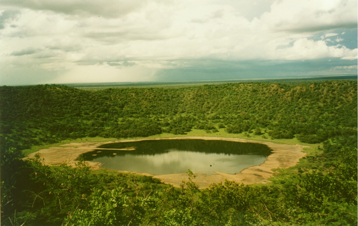
Tswaing or Pretoria Salt Pan Crater South Africa .
Forty kilometers
north of Pretoria lies a ring of hills
a kilometer in diameter and 100 meters high. These
hills are the walls
of an impact crater left by an asteroid which hit
there some 200, 000 years
ago. The Tswaing crater is similar in size to the
well known Barringer
meteor crater in Arizona. The crater walls at
Tswaing were originally about
twice as high as they are today.
The crater is called Tswaing in seTswana, the local language of the area, or Soutpan in Afrikaans. Both names mean Salt Pan and this derives from the lake of salty water that fills the center. - SOURCE The photograph above is taken during the dry season, while the one below is taken during the rainy season. Both show you what it looks like today.
Photo courtesy of Martin Tuchscherer, University of the Witwatersrand tuchscm@science.pg.wits.ac.za |
||||
|
Kalkkop Crater South Africa .
Kalkkop is an impact crater and can be found on a private farm 48.3 km south west of the town of Graaff-Reinet in the Eastern Cape Province of South Africa. Co-ordinates (32°43'S, 24°34'E). The name is derived from two Afrikaans words, namely "kalk" meaning limestone and "kop" meaning head. The meteor impact occurred just under 1.8 million years ago (in Pleistocene) on what is now the flat Karoo landscape. It left a crater 640 m in diameter and a few hundred meters deep. Over time, draining water left a limestone deposit 88.4 m deep. This lies over a breccia layer a further 210 m deep. Only a weathered circular ridge is still visible at the surface. |
||||
|
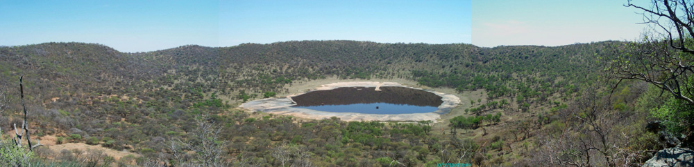
Morokweng Crater South Africa .
An impact crater, about 160 km (100 miles) in diameter, that lies buried under the sands of the Kalahari Desert sands near Morokweng, in the northwest part of South Africa (latitude 26° 28' S, longitude 23° 32' E). The Morokweng crater has an estimated age of 145.0 ± 0.8 million years, placing it at the boundary of the Jurassic and Cretaceous periods. It was created by an asteroid measuring about 5-10 km (3-6 miles) in diameter. In 2006, scientists recovered meteorite fragments from the crater at a depth of 770 meters (2,500 ft). These fragments may not have been attached to the asteroid but may have trailed behind it as it entered Earth's atmosphere. They are among the oldest meteorite specimens ever found on this planet. |
||||
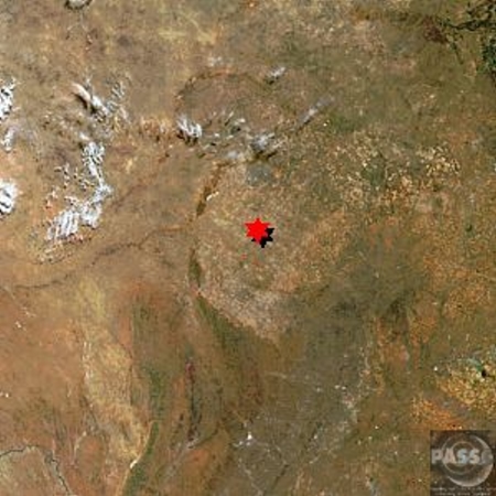
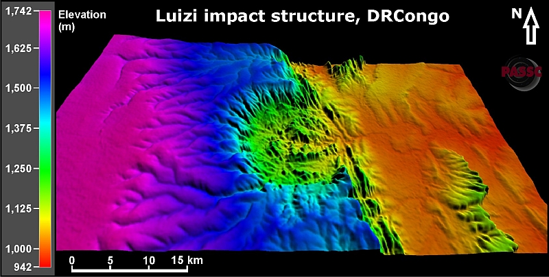 DEM Image Provided by Dr. Ludovic Ferrière 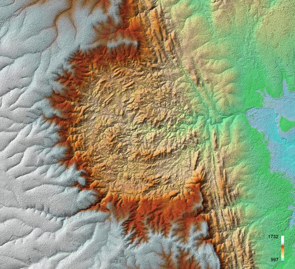 TanDEM-X elevation model of Luizi (provided by Manfred Gottwald,German Aerospace Center) |
||||
|
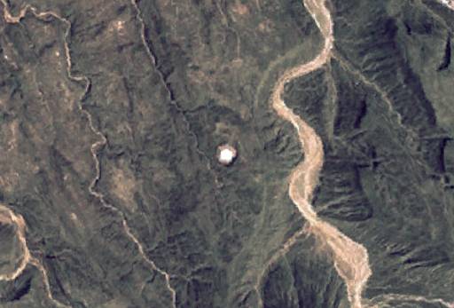
Huge Meteorite Crater Discovered in Eastern Jordan A huge crater caused by a gigantic meteorite has been discovered recently in the eastern part of Jordan, the largest meteorite crater in the region, the Jordan Times reported on Tuesday. The impact site in Jabal Waqf es Swwan, some 200 km east of the Karak governorate in eastern Jordan, was discovered by geology professors of University of Jordan Elias Salameh and Hani Khoury, along with German professor Werner Schneider. A meteorite struck the area around 7,500-10,000 years ago with an impact diameter of about 100 meters, the report said. "The damage force of such an impact might equal 5,000 times that of the Hiroshima atomic bomb," Salameh said, adding that it would have destroyed everything within a radius of hundreds of kilometers. The crater consists of two concentric circles. The diameter of the outer ring measures around 5.5 km, with the inner ring measuring 2.7 km. The impact size and velocity, according to Salameh, would have raised the atmospheric temperature within a radius of 10 kilometers to more than 1,000 degrees centigrade, spewing millions of tons of rocks, vapor, dust and smoke into the atmosphere. The discovery is thought to be the largest such meteorite crater in the region, a statement issued by the University of Jordan said. Salameh said that the site is expected to explain many geologic and historic features and events such as calcinated rocks, molten rock, highly jointed and cracked rocks |
||||
| FAIR USE NOTICE: This page contains copyrighted material the use of which has not been specifically authorized by the copyright owner. Pegasus Research Consortium distributes this material without profit to those who have expressed a prior interest in receiving the included information for research and educational purposes. We believe this constitutes a fair use of any such copyrighted material as provided for in 17 U.S.C § 107. If you wish to use copyrighted material from this site for purposes of your own that go beyond fair use, you must obtain permission from the copyright owner. | ||||
|
|